
This is the second article in my series of more remote trails in the Moab area. Naturally, if it’s your first visit to Moab with your Bronco, you’ll want to drive the legendary trails like Hell’s Revenge, Fins & Things, and Poison Spider Mesa. But, if you want a day away from the crowds, where the scenery feels bigger, and other vehicles are few and far between across starkly different desert terrain, the Crystal Geyser Trail should be high on your Bronco bucket list.
Located between Moab and Green River, Utah, the Crystal Geyser route takes drivers through colorful badlands, remote desert mesas, and forgotten mining roads before ending at one of Utah’s most unusual natural attractions, a cold-water geyser powered by carbon dioxide rather than geothermal heat. According to OnX Offroad, the trail covers roughly 22 miles and combines moderate technical driving with spectacular scenery that feels worlds away from downtown Moab.
Crystal Geyser Trail Overview
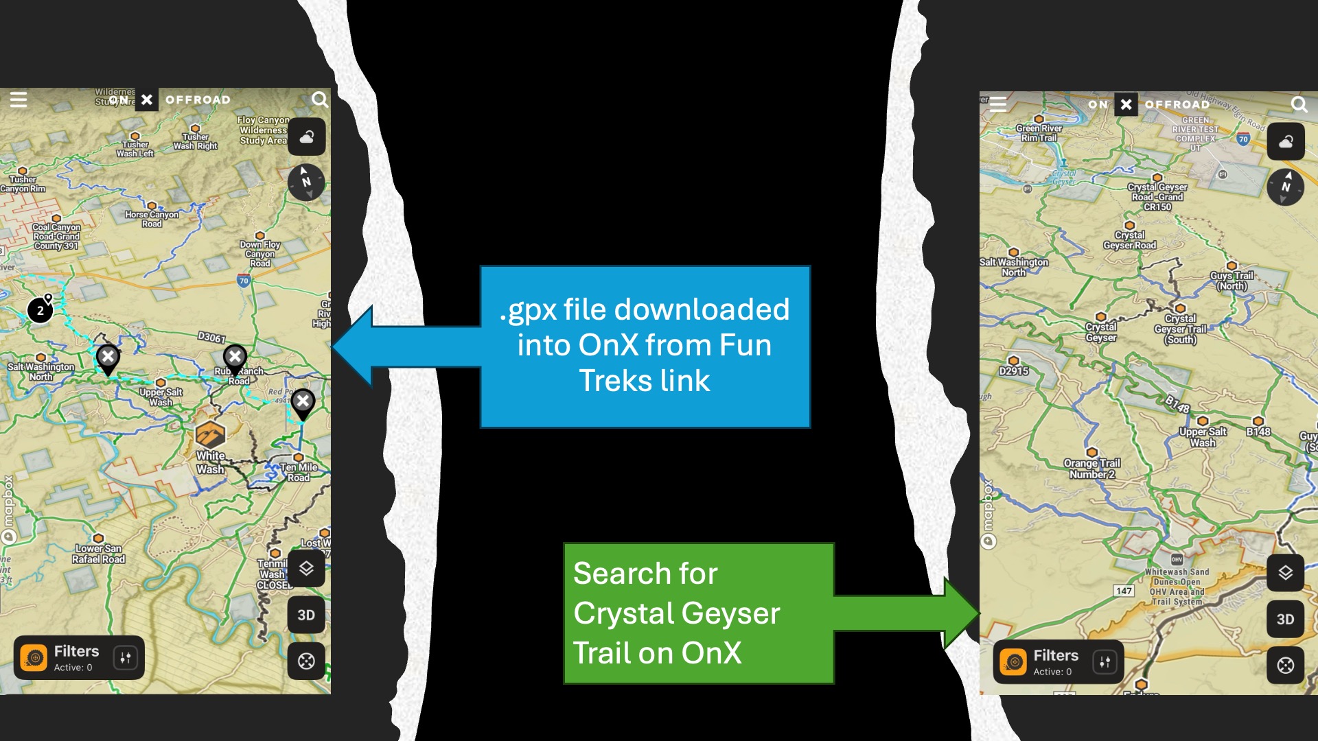
The Crystal Geyser Trail begins northwest of Moab and traverses a landscape unlike many of the area's more famous slickrock routes. Instead of steep sandstone domes and heavily traveled trails, you'll encounter rolling badlands, bentonite hills, colorful desert formations, and long stretches of remote two-track. If you’re using OnX to curate your route, you should start by searching for Crystal Geyser Trail, making sure you’re not getting the singletrack route. You’ll see the most direct path to get to the trailhead is from 191 is along graded dirt Blue Hills Road, located just south of the Moab airport. You can download a file from FunTreks into OnX if you want the exact Easter Jeep Safari route.
Once you start on this route, you may pass a few dispersed campers and vans but the farther you progress, the fewer people you’ll see. The terrain here is much different than the red rocks of Moab and look more like driving on the moon. A quick warning, if there have been recent rains or heavy rain is forecasted, avoid Blue Hills Road, the bentonite clay is a nightmare when wet and getting stuck is likely.
For a stock Bronco, the trail is well within the vehicle's capabilities but the first couple of miles are the most difficult and can be easily bypassed by simply choosing another route and rejoining the trail. Bronco Sports, particularly Badlands or Sasquatch models equipped with all-terrain tires and skid plates may be able to complete the entire route, although careful tire placement and spotting may be required. Again, try it and turn around if you don’t like what you see.
While thousands of visitors’ crowd Moab's signature trails each spring and fall, Crystal Geyser often sees only occasional traffic, anytime we’ve visited the geyser, it’s just been us. The trail too is sparsely traveled, you’ll likely see more ATVs and motorcycles than anything else.
A Landscape That Feels Like Another Planet
One reason Crystal Geyser stands apart is the terrain itself.
The route crosses sections of colorful Morrison Formation badlands where layers of gray, red, purple, and tan soil create a landscape that looks almost lunar. Utah.com describes portions of the area as "moon-like terrain," a fitting comparison once you leave the pavement behind and begin winding through the rolling hills and dry washes.
Drivers pass near the Rainbow Rocks area and remnants of historic mining activity while navigating sandy roads, clay surfaces, and occasional rocky sections. Depending on recent weather, the route can vary considerably, which is one reason downloading offline maps is highly recommended before leaving cell service behind.
The expansive views are particularly rewarding in the early morning or late afternoon when low-angle sunlight highlights the colorful terrain and distant mesas.
The Destination: Crystal Geyser
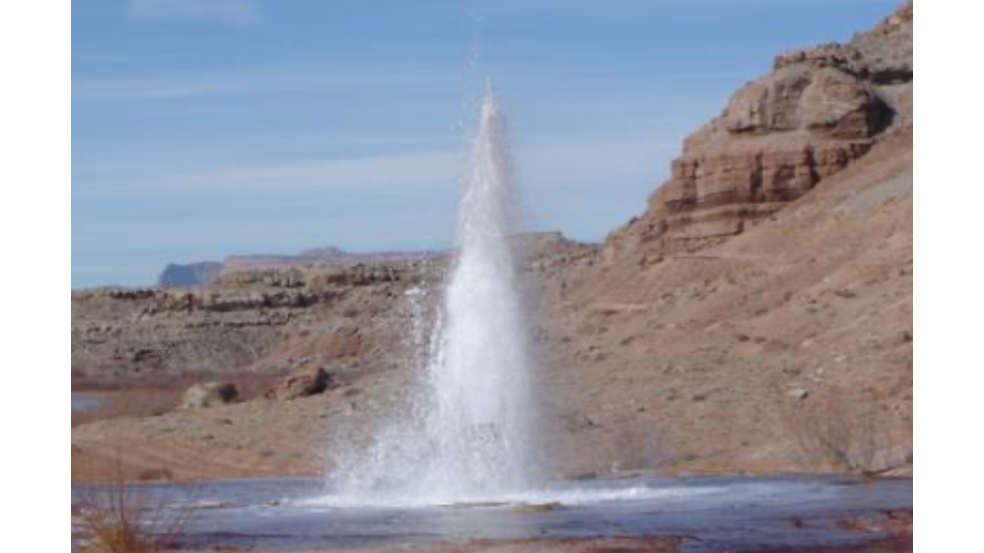
The trail eventually arrives at Crystal Geyser itself; a fascinating geological oddity located near the Green River.
Unlike Yellowstone's geothermal geysers, Crystal Geyser is powered by naturally occurring carbon dioxide trapped underground. The geyser was created from a drilled well and periodically erupts cold mineral-rich water, sometimes reaching impressive heights. Eruption timing is unpredictable; visitors may witness only a gentle bubbling spring or arrive during a more dramatic eruption.
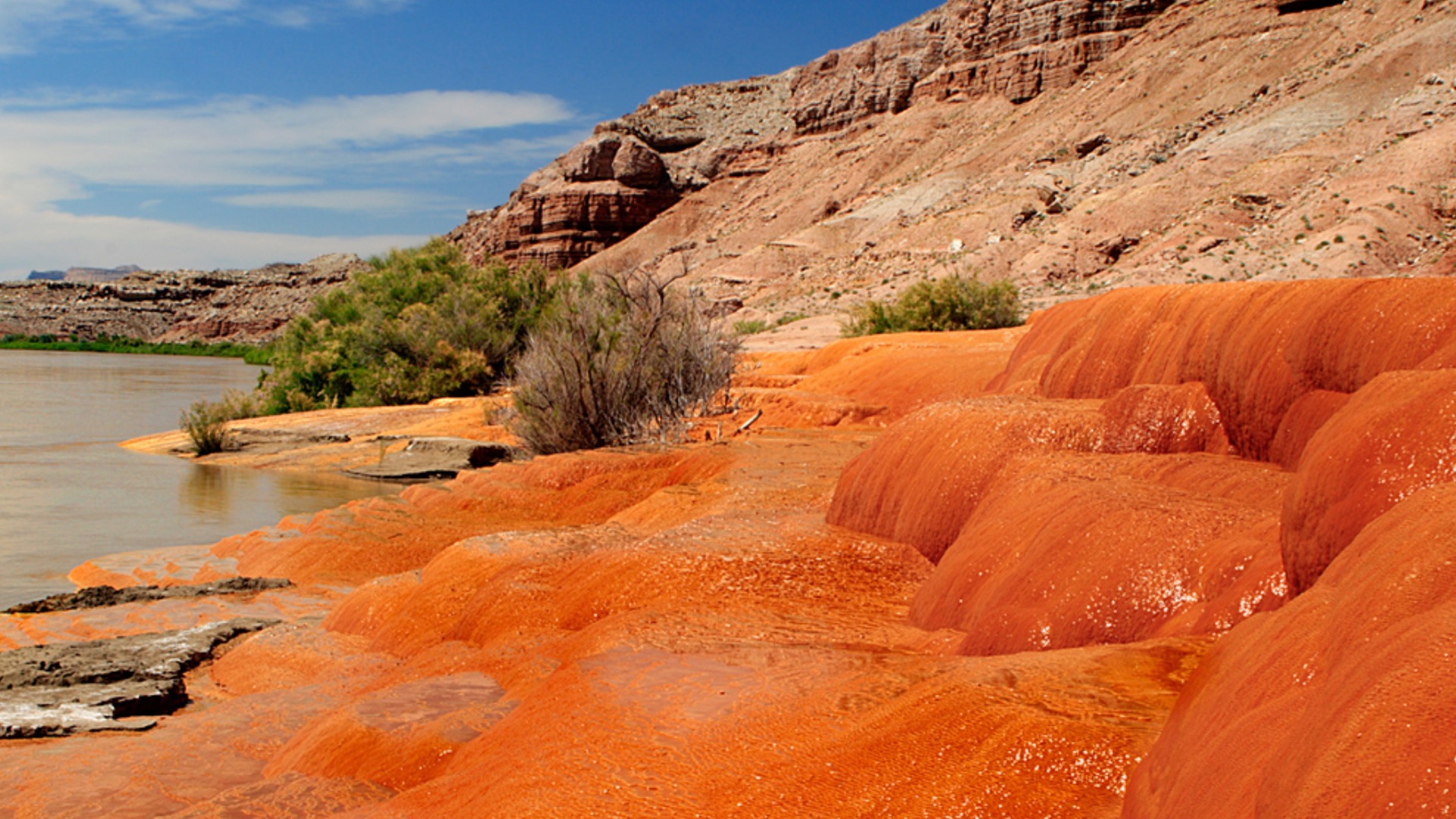
Even when inactive, the site is worth the drive. Mineral deposits have created colorful formations around the vent, and the nearby Green River corridor provides a scenic place to stretch your legs before beginning the return trip.
Why OnX Is Essential for This Route
One of the best reasons to use OnX Offroad on the Crystal Geyser Trail is the route's remoteness.
Unlike trails located immediately adjacent to Moab, this area contains a network of intersecting roads, old mining tracks, and exploratory routes. OnX provides downloadable offline maps, trail descriptions, and waypoints that help drivers stay on designated routes.
Before departing, download the area for offline use and review any recent trail reports. Carrying a paper backup map is also a great idea whenever traveling in remote desert environments.
Side Trip: White Wash Sand Dunes
If you're making a full day, and why wouldn’t you, out of your Crystal Geyser adventure, a nearby area worth checking out is the White Wash Sand Dunes.
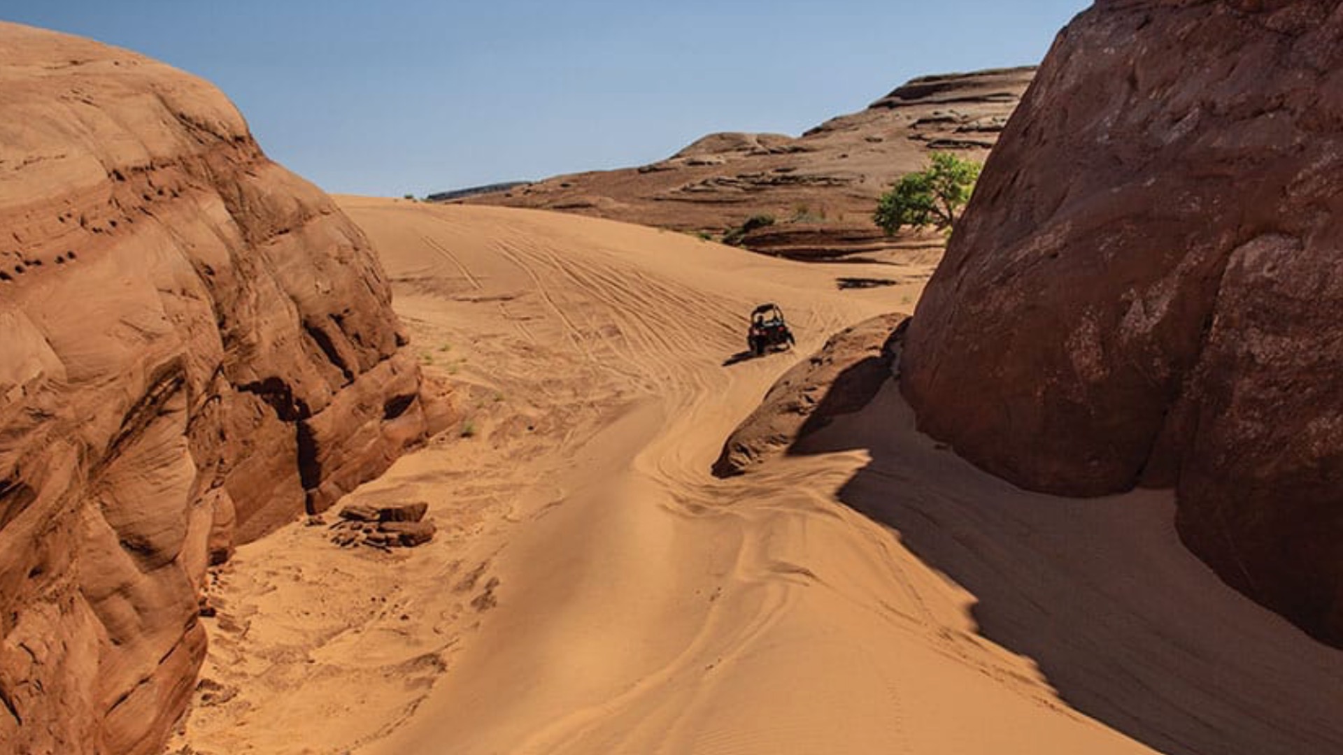
Located approximately 48 miles northwest of Moab and about 25 miles southeast of Green River, White Wash is one of Utah's premier OHV recreation areas. Managed by the Bureau of Land Management, the area combines open sand dunes with an extensive network of designated off-road routes.
For Bronco owners, White Wash offers an entirely different driving experience from Crystal Geyser.
Instead of rocky badlands and wash crossings, drivers can explore sweeping sand bowls, dune climbs, winding sandy washes, and sandstone formations. The open riding area allows for playful exploration while still providing plenty of opportunities to practice momentum management and sand-driving techniques.
Airing tires down significantly improves traction and ride quality in the dunes. Make sure you bring your traction boards and a shovel, as well as an orange whip flag for safety and let someone know where you’re headed, you can definitely get stuck in these dunes.
Camping and Logistics
Dispersed camping opportunities exist throughout much of the Crystal Geyser and White Wash region on BLM-managed land. The remote setting makes for outstanding stargazing and quiet evenings around camp. If camping is your thing, you may want to spend a couple of days here. There are so many side routes and interesting ways to travel to the south to access Moab.
Spring and fall generally provide the most comfortable temperatures. Summer heat can be extreme, while winter storms occasionally create muddy conditions that can quickly make portions of the trail difficult or impassable.
A Different Side of Moab
Rather than waiting in line at trail obstacles or competing with crowds for parking spots and campsites, this route rewards drivers with solitude, scenery, and a genuine sense of exploration. Combined with a visit to White Wash Sand Dunes, it creates a full day of off-roading that showcases a quieter, more remote side of Utah's canyon country.
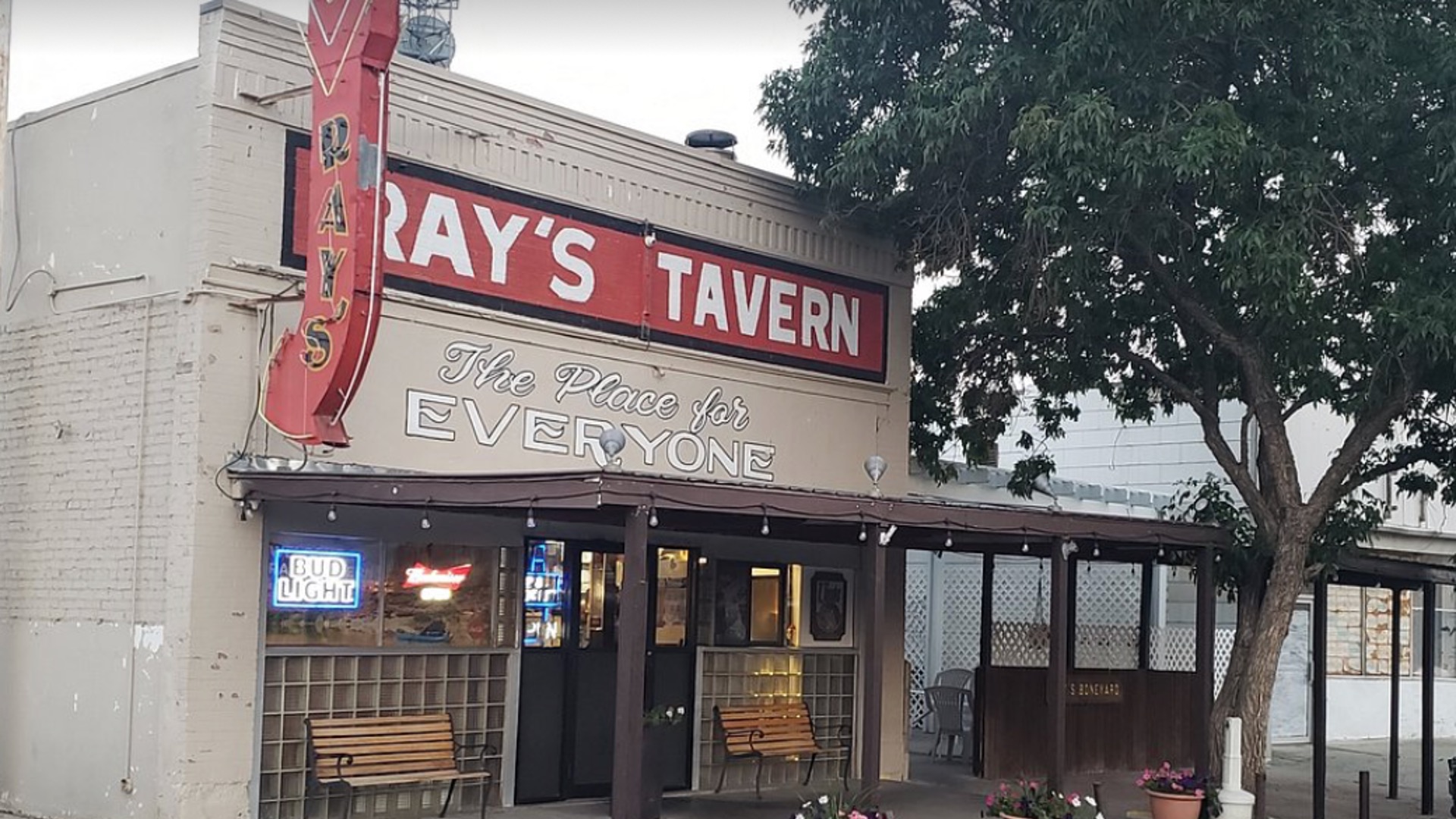
If you like a good hamburger, and who doesn’t, consider traveling up to Green River for dinner and check out tiny Ray’s Tavern that’s been in business since 1943, considered by many to be the best burger anywhere. I love the fries too.
If you take this route, comment below and let me know how it went!
Comments
You must log in or register to post here.