
If you’ve spent any time in Moab, you know the patterns: people hit the most popular trailheads, tow rigs and trailers are everywhere, there’s a backup of rigs by mid-morning and the parking lots are full, and by noon, the routes feel more like traffic jams than trails. This town, and area, are epic for off-roading but the majority of visitors head to the same few trails. While icons like Hell's Revenge and Fins and Things earn their reputation, they’re not always where you go when you want solitude. And, when you take a day off from trail riding, you find even more crowds in Arches and Canyonlands with long waits, no parking, and definitely no solitude.
For Bronco Nation members looking to trade crowds for quieter trails, I’m going to share some of my favorite recommendations in a series. These are places we visit and where we take friends when we want to show them the desert. Don’t get me wrong, Hell’s Revenge is a must-do trail but when you come out, maybe set a day or two aside to visit one of these beautiful spots. This first one is called Willow Springs Road to Tower Arch.
Starting at Willow Springs Road
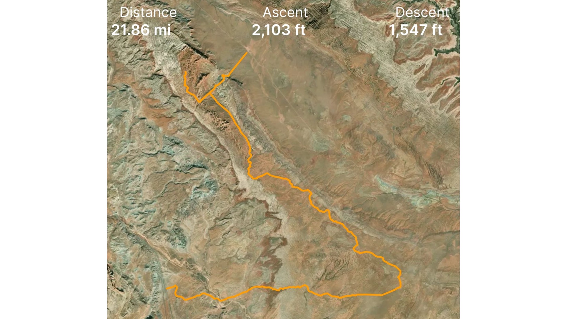
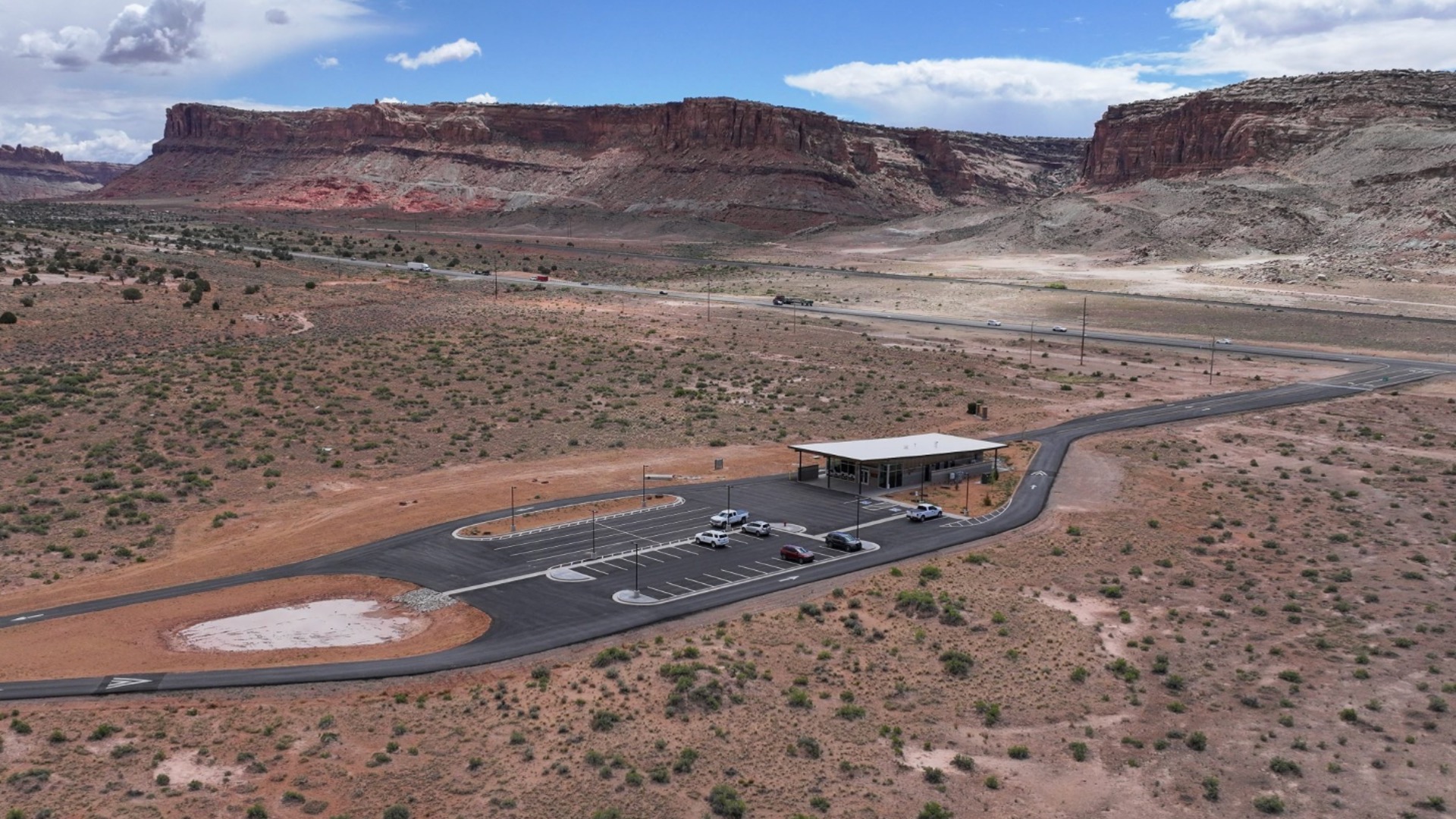
First of all, this road isn’t easy to find because it has recently been re-routed through our new Raptor State Park. Located north of town, Raptor State Park has a small visitor center and a gate, similar to the National park entrances. As you drive up, just mention to the ranger that you are wanting to access Willow Springs and then turn right at the first intersection. (There is a sign). You’ll follow a narrow-paved road back south until it dead ends into Willow Springs. Make a left-hand turn, now heading east(ish), and you’ll drive on a good gravel/dirt road for 3 miles with a rockier ½ mile before you reach the boundary of Arches National Park. On this part of the drive, watch for the signs keeping you on Willow Springs or towards Arches, there are several campsites as well as mountain bike trailheads in this area.
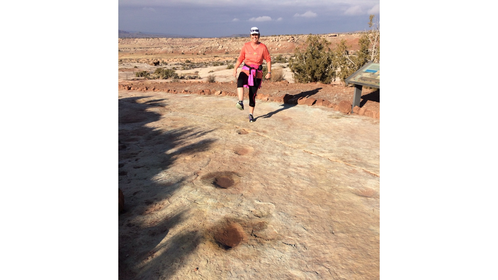
Check Out the Dinosaur Tracks
The Moab area is riddled with tracks and this example, literally right next to the road, is worth a 5-10 minute stop. You’ll see the kiosk on the passenger side shortly after the trail transitions to rock. At this point, you’ll probably still have some mountain biking traffic but the further you go, that should really decrease.
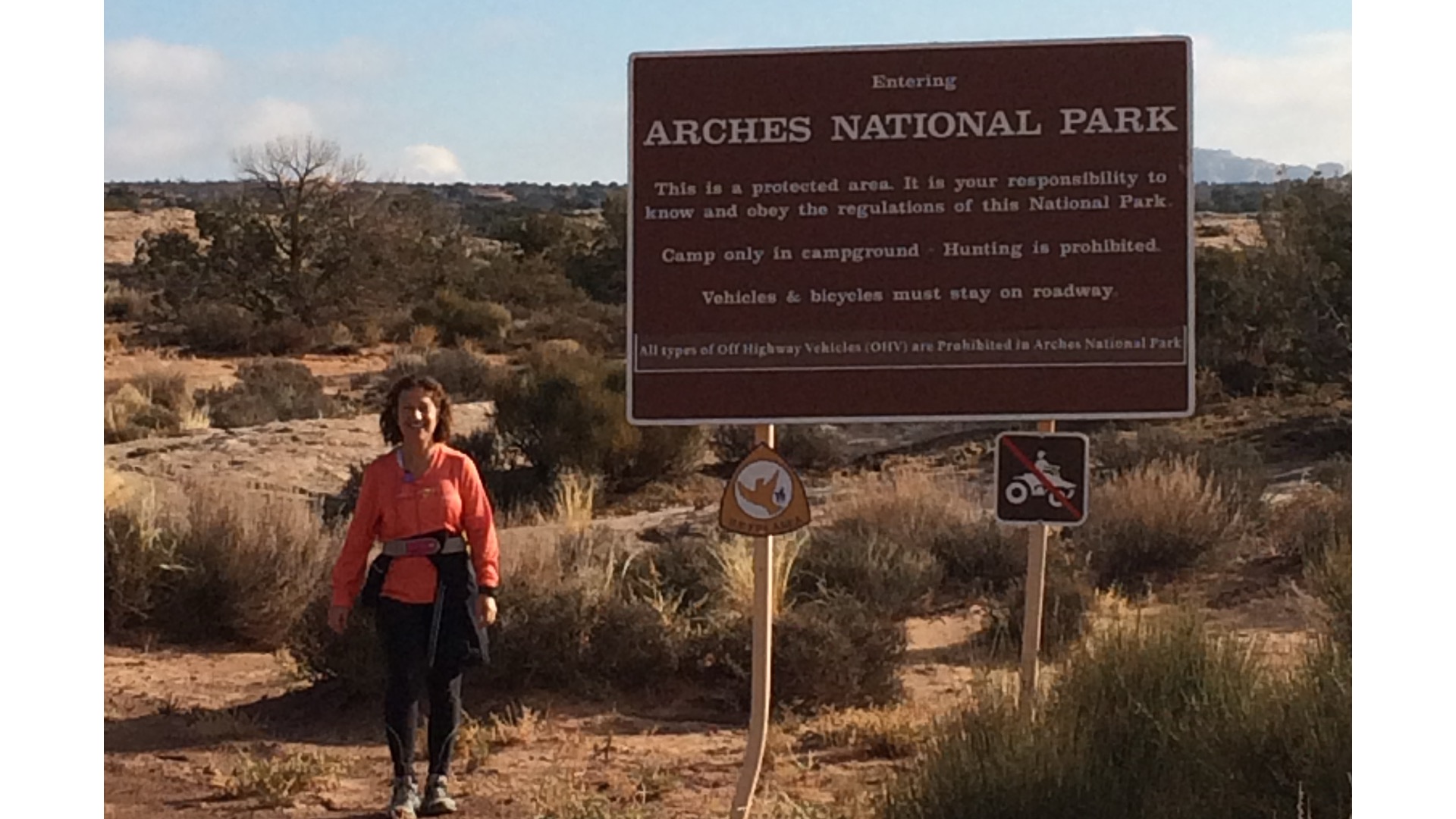
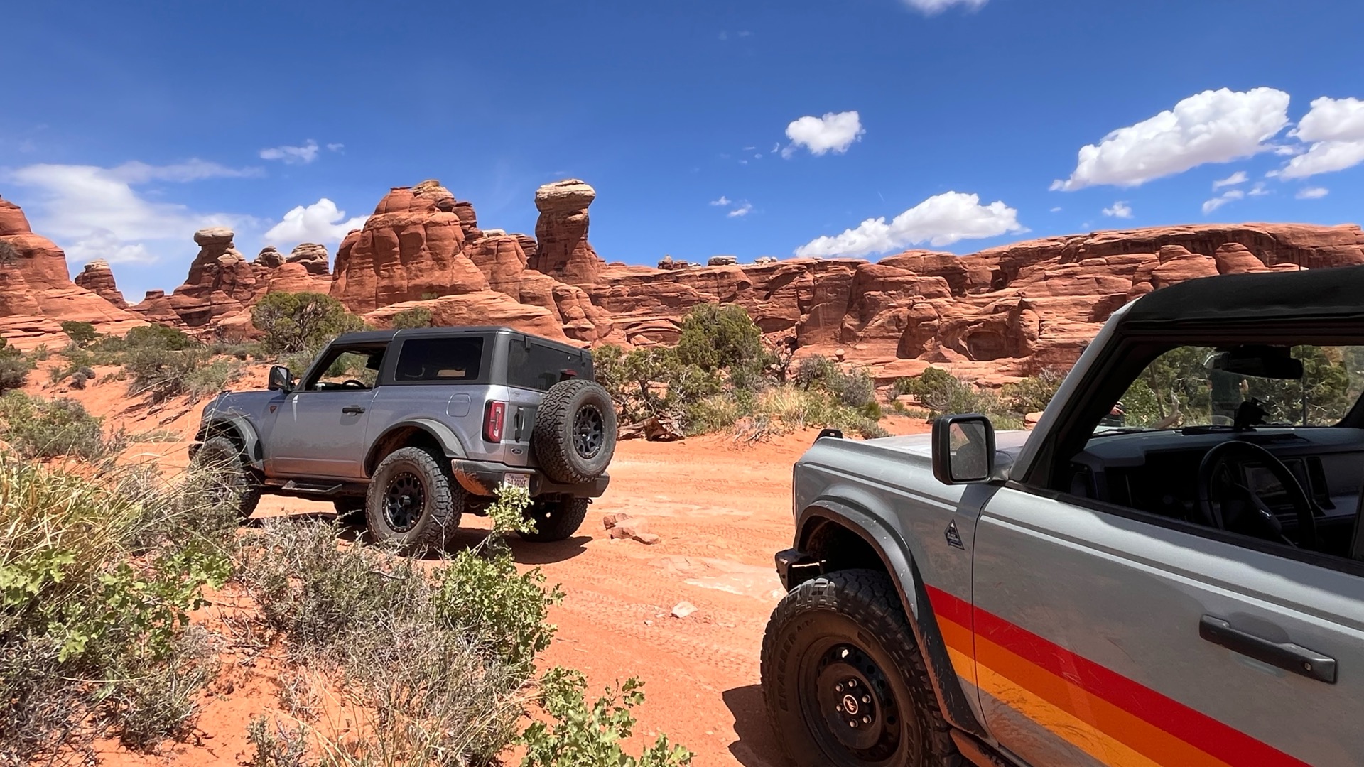
After returning to your Bronco, continue heading up the trail.It will degrade and become really rocky right at the boundary sign to Arches. I shift into 4 low here, just for the control. You will not need a locker so if you chose a mode like rock crawl, make sure your rear locker is turned off. The rocky descents and ledges are short lived, you might want to have a spotter or get out and take a look, some of the ledges are larger on one side or the other. Once you are down in the sand again, after one more ledgy climb, you’ll be able to increase speed and may consider 4H. You’ll travel along for another 3 miles, taking in the scenery and hopefully now, the solitude. After passing small Football arch, (stop quickly if you must but there’s another arch worth visiting not too far away,) you’ll come to a large sign and a left-hand choice. This is your trail to Tower Arch. If you’ve had enough at this point, you can stay straight and it’s a fast and easy drive to the pavement near Balanced Rock in Arches and from there a scenic and crowded drive back to the entrance and 191.
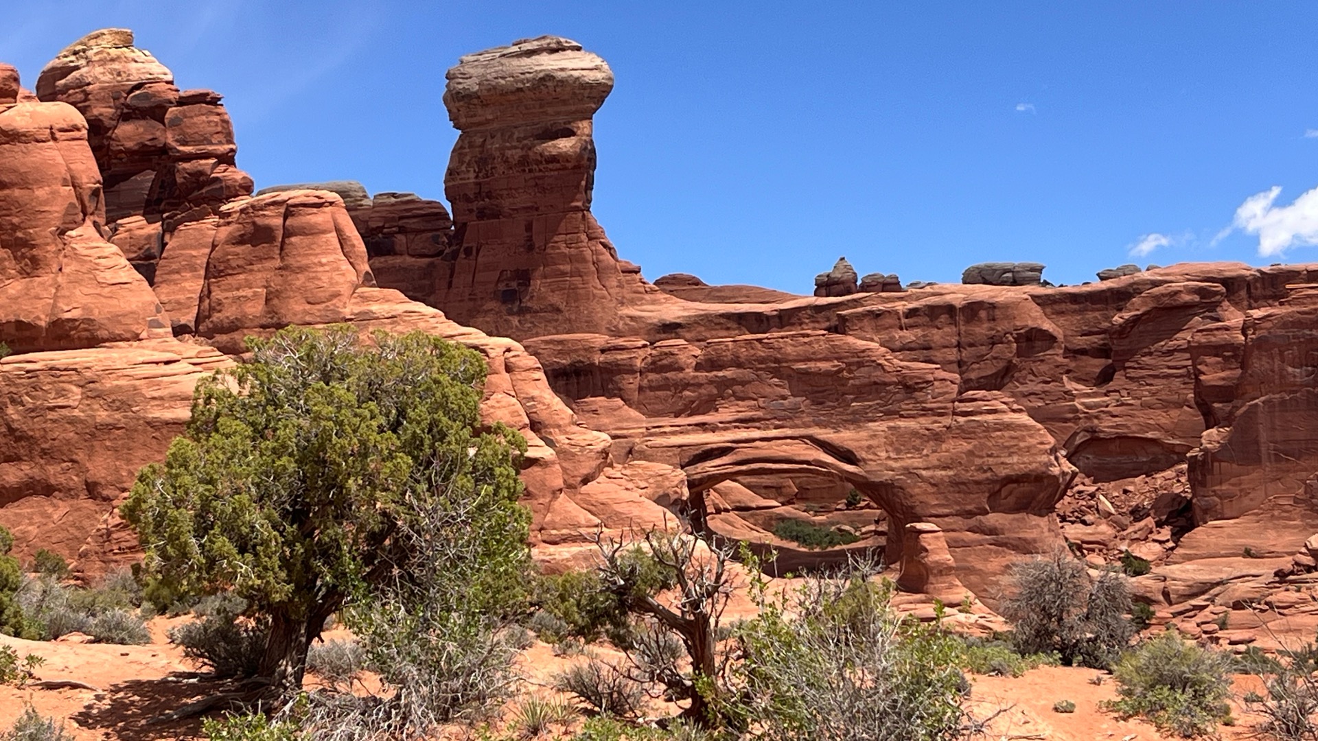
Eye of the Whale Arch
Shortly into this trail, the difficulty level creeps back up, and you’ll find that you may want 4 low again. The road is still easy to moderate so keep on for 2 miles until you reach Eye of the Whale Arch. If you’ve got a half hour, I recommend taking the short hike to the Arch. It’s pretty easy to stand under the arch by staying to the right of the arch and getting up on the rock. The total hike there and back is less than ½ a mile.
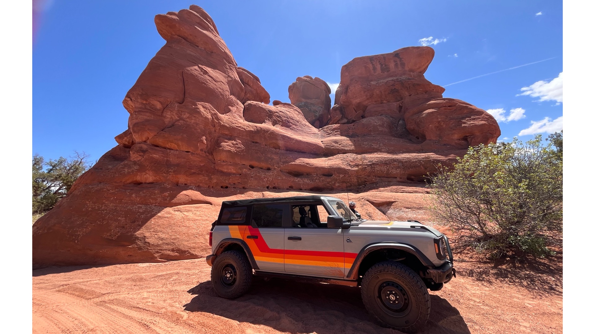
On to Tower Arch
The trail gets increasingly sandy and rocky in areas, and it’s incredibly beautiful. Get the camera out, get the GoPro started because this is what the National Park is all about. This route will go on for 7.75 miles until you reach a T intersection. Before that point though, you’ll find the largest obstacle of the trail, climbing up a steep slickrock climb. It’s really not as crazy as it looks, if you have a rear locker, use it now but it can be driven without one. Take your time, spot each other, have fun. At the T, turn left and travel on for 1.5 miles until you reach Tower Arch. The trail can at times be tricky to find, watch for tracks or black marks on the road. Park and have lunch, hike out to the Arch (it’s a harder hike and can be confusing but that’s fun level 2, you’ll figure it out).
Marching Men Exit
After fun at Tower Arch, return the way you came until you reach the intersection and stay straight, it will be slow going as you climb up, with a view of the Marching Men rocks out your driver’s window. This route is 1.75 miles until you reach Salt Valley Road and used to be the hardest part of the trail. It was repaired a few years ago and seems to be in pretty good shape but take your time.
Once down, use Salt Valley to enter Arches by turning right. It’s another 7 miles to the pavement but if not too wash boarded, you can travel at a decent pace. Now, depending on time, you can either enjoy the park or travel the scenic road back to 191. You can turn left on Salt Valley and reach 191 in 11 miles, but you’re headed mostly north so once you reach the highway, you’ll have a 27-mile drive back to Moab but if you’re headed out, you’re less than 5 miles to I-70 so maybe consider this for your last trail. This trail with all the stops usually takes us 5-6 hours from the start at Raptor State Park to Salt Valley and is a great trail with a tour of part of Arches Park few see. This is my favorite lesser traveled trail and I hope you enjoy it too. (If you’re in a Bronco Sport, go as far as Eye of the Whale but I recommend turning back from there.)
Comments
You must log in or register to post here.