
It's Pronounced YOU Ray
It’s nearly Independence Day and the weather here on the Colorado Plateau has been hot with many days reaching 100 degrees. Brian and I are always thinking about going on trail rides and when it’s hot, we think about the mountains. Some friends from Grand Junction just bought a new Bronco, so we decided to beat the heat and get them up on a trail in the San Juan mountains.
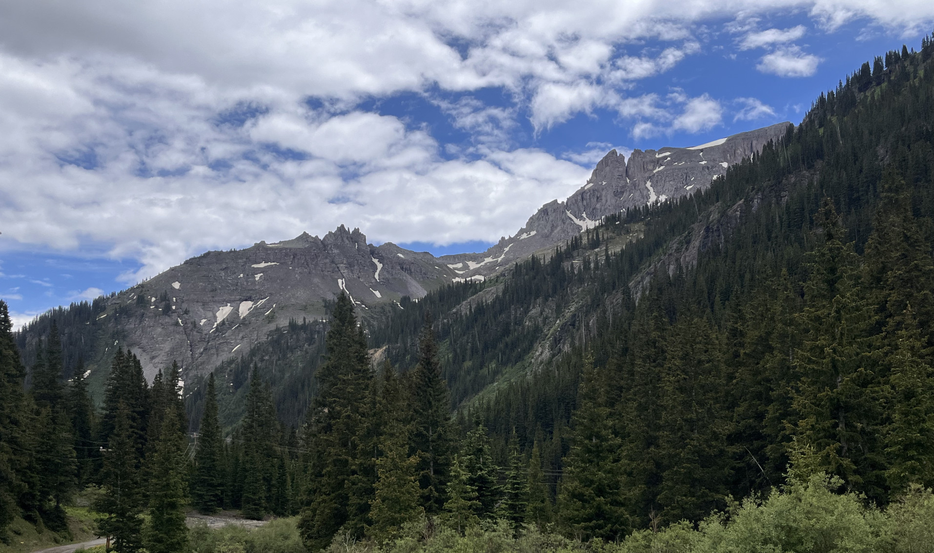
The mountain town of Ouray (pronounced YOU ray or you RAY) is our favorite gateway to miles and miles of scenic mountain passes and is just a two hour drive from our home near Fruita, CO. We had been asked if we could show our friends some of the Bronco features and we decided that the mountain trails would be the best way to get at different terrains while enjoying cooler weather and fantastic scenery.
We Loaded Up the Broncos.....
We loaded up the dogs, picked up my mother-in-law and met our friends at a coffee shop at the edge of Grand Junction. This made it a party of nine, five people and four dogs in two Broncos. Over pastries, we looked at the maps and discussed the many trail options available and decided on a trip up to Yankee Boy basin.
Although the name sounds patriotic, the area has its name from the Yankee Boy Mining Company, a Boston based group that developed the early mines in the area. In fact, most of the roads entering high into this mountainous terrain were developed to get at the rich minerals of the San Juans, with mines producing millions of ounces gold and silver. It’s incredible to see mines at such high elevations where realistically the season was only a few months long before winter descended once again. The route we will be driving is at least 125 years old and the history of the area is just as amazing as the wildflowers and scenery.
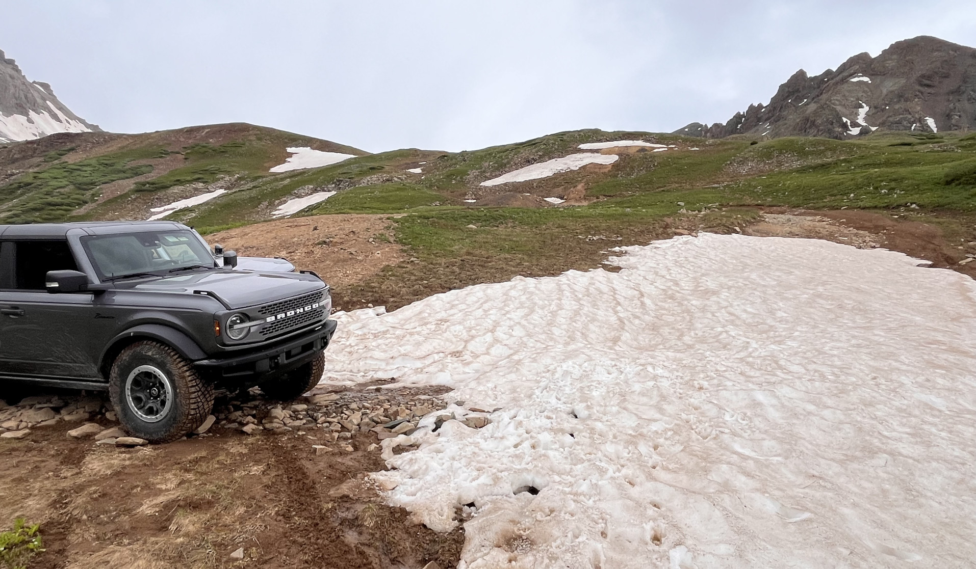
The Trail Starts on Camp Bird Mine Road
We handed out a radio so we could communicate between Broncos on the drive and continued onto Hwy 50, passing through Delta, Montrose, and Ridgeway, before arriving in Ouray around 10am. The transition to the dirt and later the more rugged Yankee Boy trail is a quick one, the Camp Bird Mine road is just above the town, less than a 1 mile drive from the mainstreet. Once on dirt, Brian switched out to ride with our friend Brian, in his brand new 4 door Badlands Sasquatch and his wife Angela rode with us.
Check Trail Conditions Before You Head Out
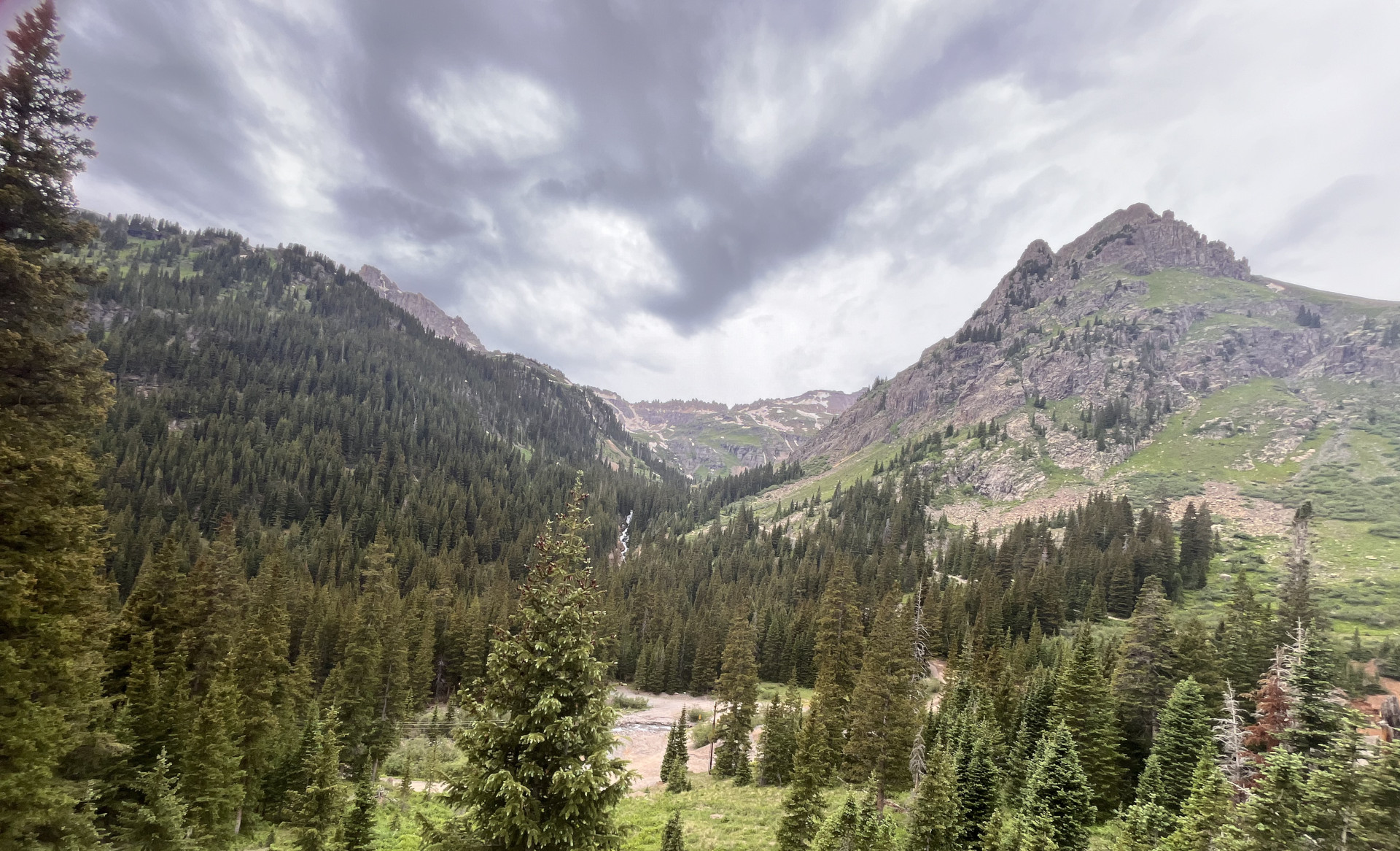
The entire Yankee Boy Basin trail (if not closed due to snow) is 9.3 miles long and climbs up from 7,800 ft above sea level to 12,400ft and yes, you can feel that elevation. It’s important to drink lots of water and be aware of symptoms of altitude sickness, the most common of which is a headache. If you feel symptoms, descend to lower elevations.
You should always check trail conditions before heading out, the site we rely on is called Ouray County Road & Bridge but we also check out Friends of the San Juans on Facebook and there are other several other forums and sites that discuss trail openings and conditions. It’s fun to watch the videos of those amazing and fearless plow drivers that work tirelessly to get some of those mountain routes open for us to enjoy.
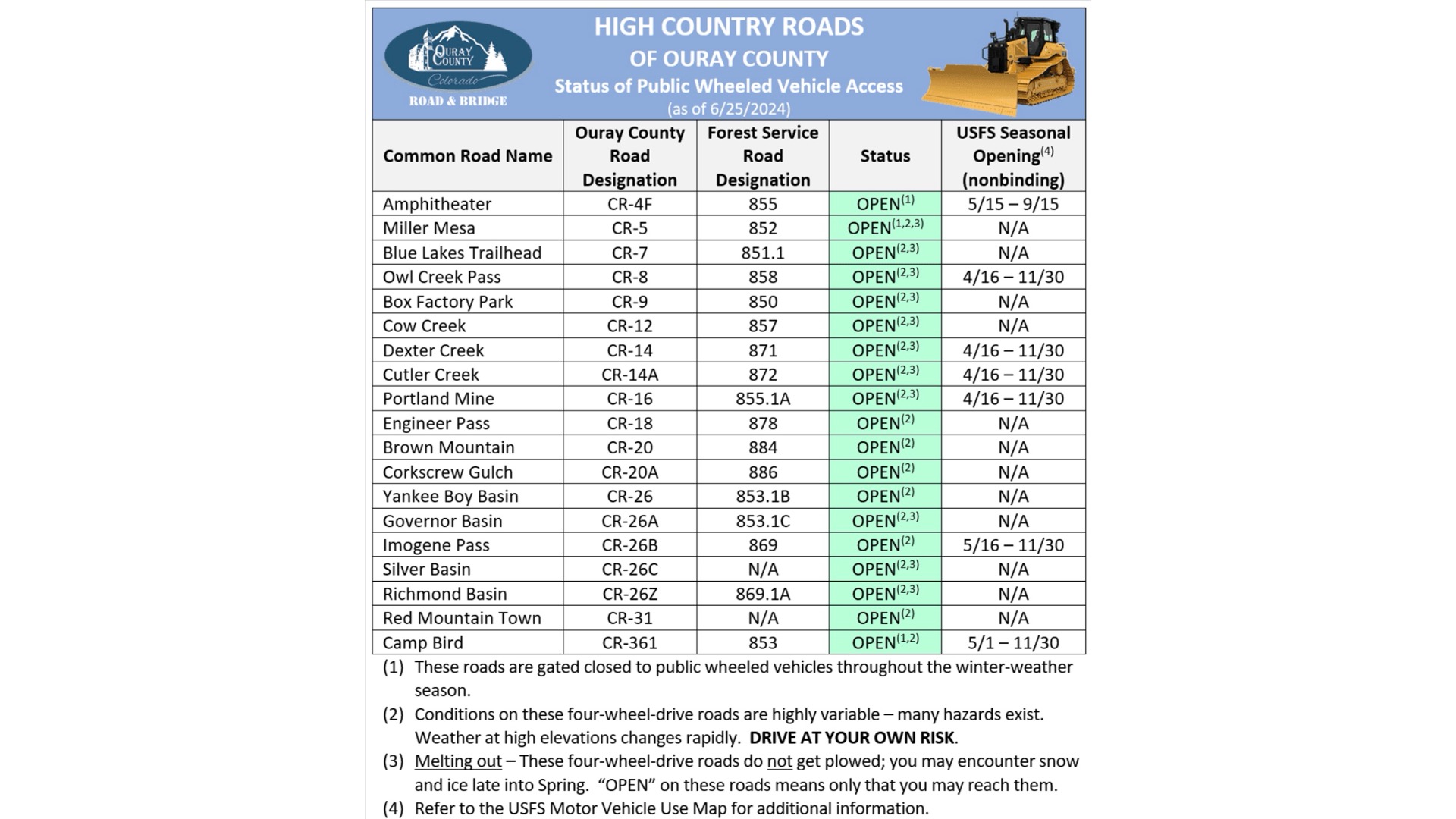
Don't Visit Too Early or Your Trail May Still Be Closed
As you can see from the report, the trails in Ouray County are all open now but the top portion of Yankee Boy has a gate that usually doesn’t open until late June. We visited Yankee Boy last year on June 12th and the gate was still closed and there were still significant snowbanks covering the trail so be aware if you are planning a once in a lifetime trip that June might still find some of your favorite trails closed.
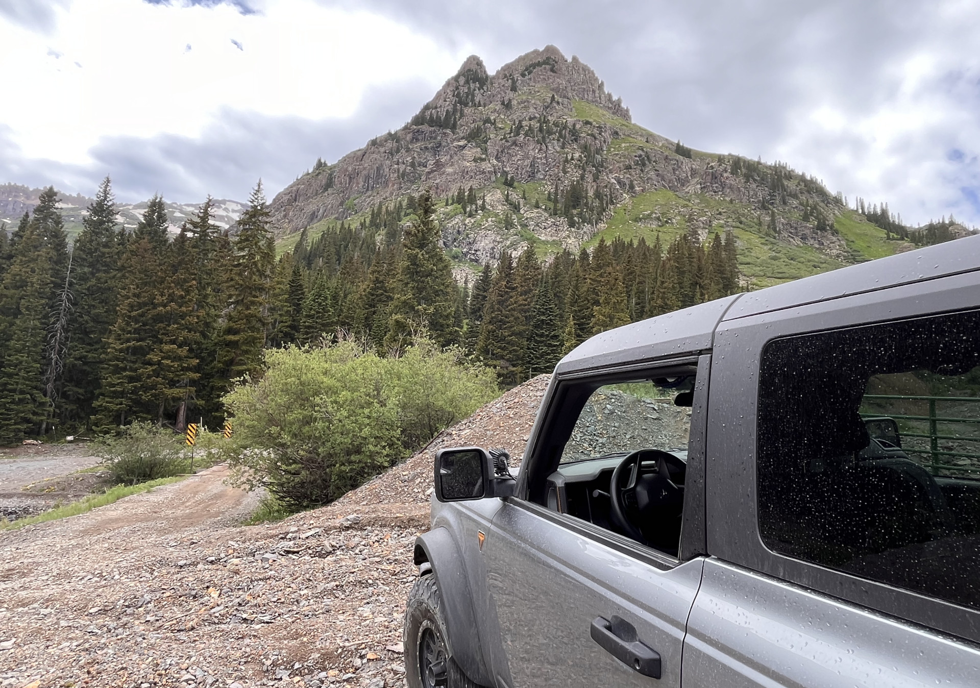
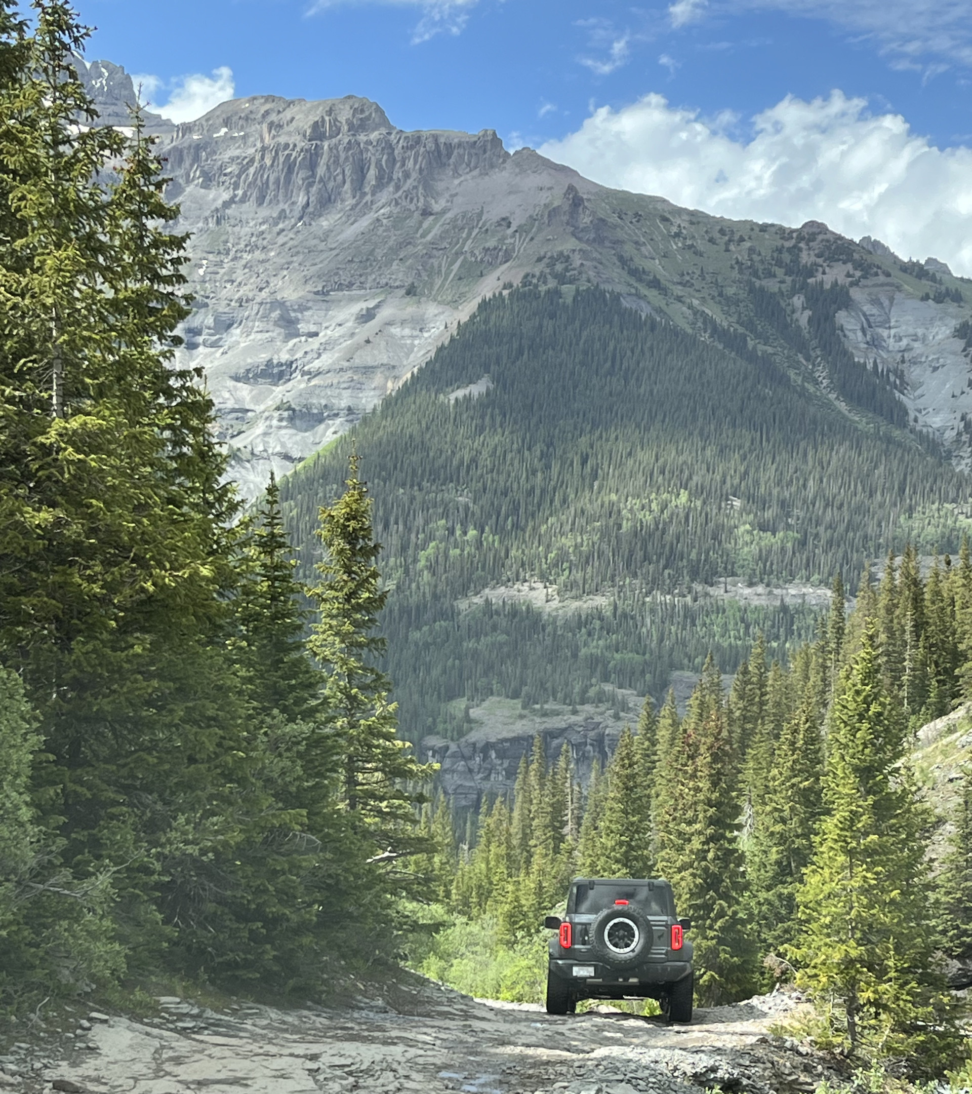
Yankee Boy Gives You the Opportunity to Try G.O.A.T Modes
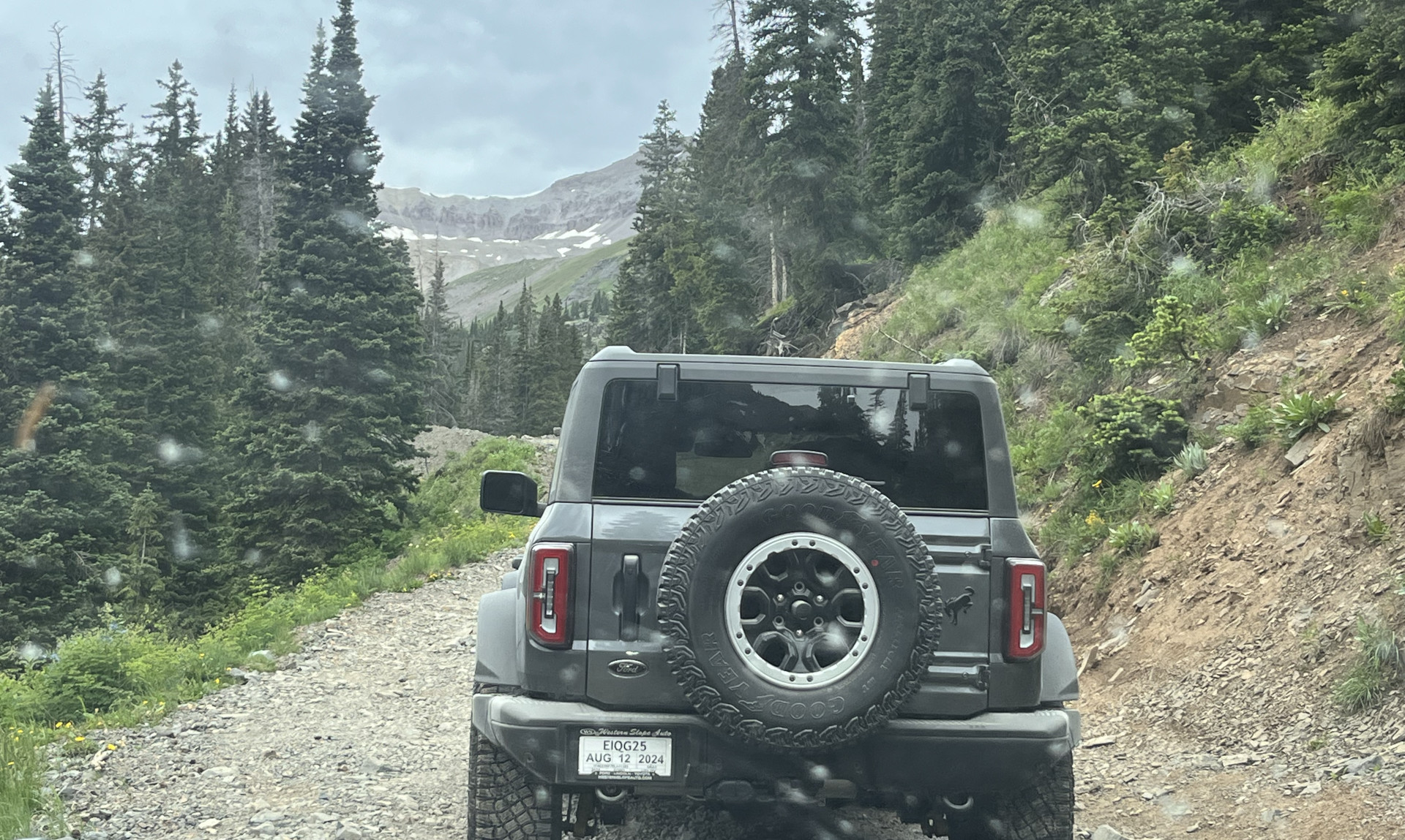
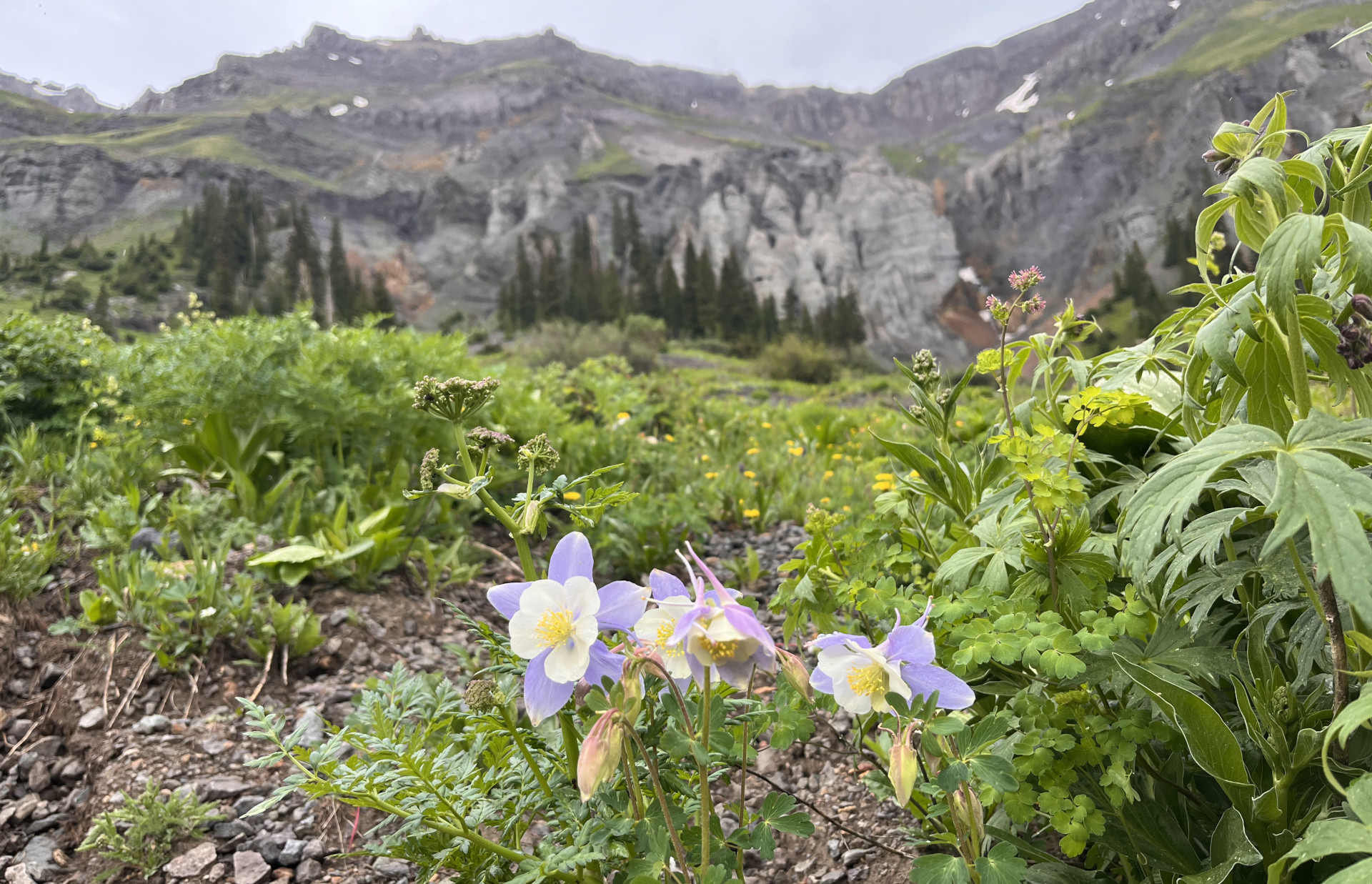
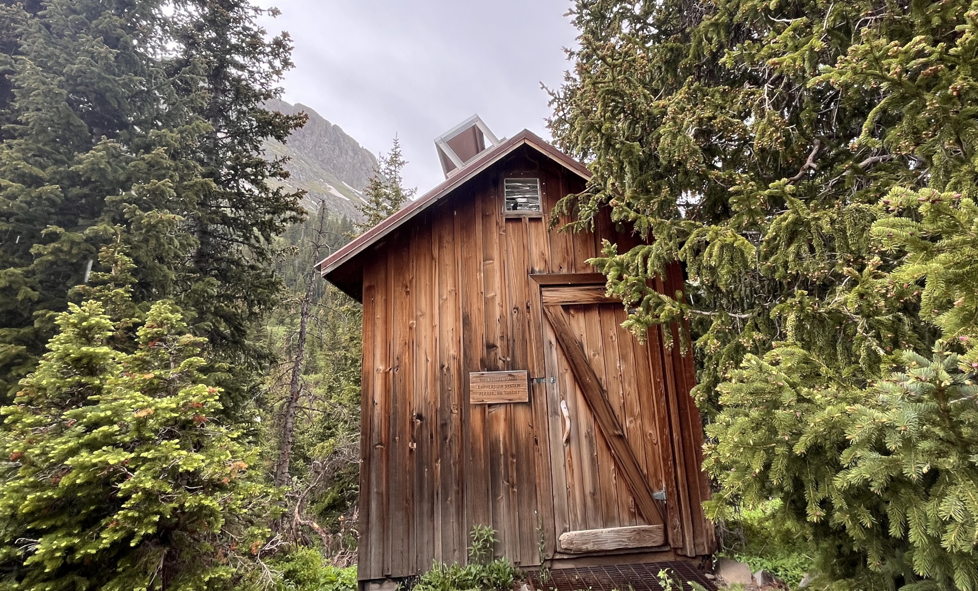
The gate (and bathroom) was open so we continued on, stopping frequently to capture photos of flowers and waterfalls. The trail immediately deteriorates and becomes much more rugged after the gate, changing from a moderate to a difficult trail rating, we watched more than one vehicle turn around when we encountered some off-camber ruts. This was a great opportunity for Brian, who hasn’t been to an Off-Roadeo yet, to learn the features of his Bronco as GOAT modes and a rear locker were needed in more than one spot as we continued to climb the rocky terrain.
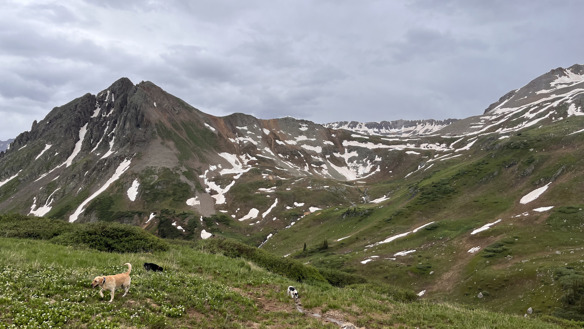
We Found a Large Snowbank.....
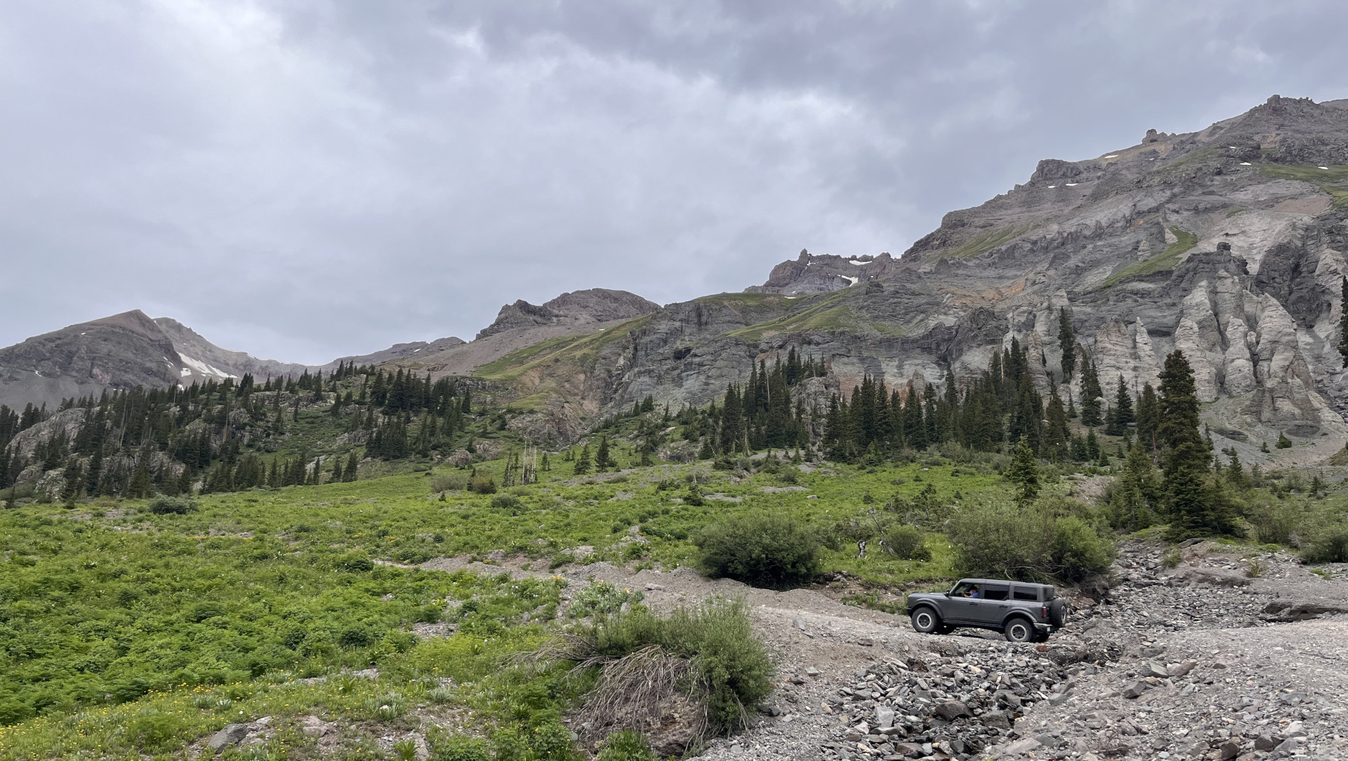
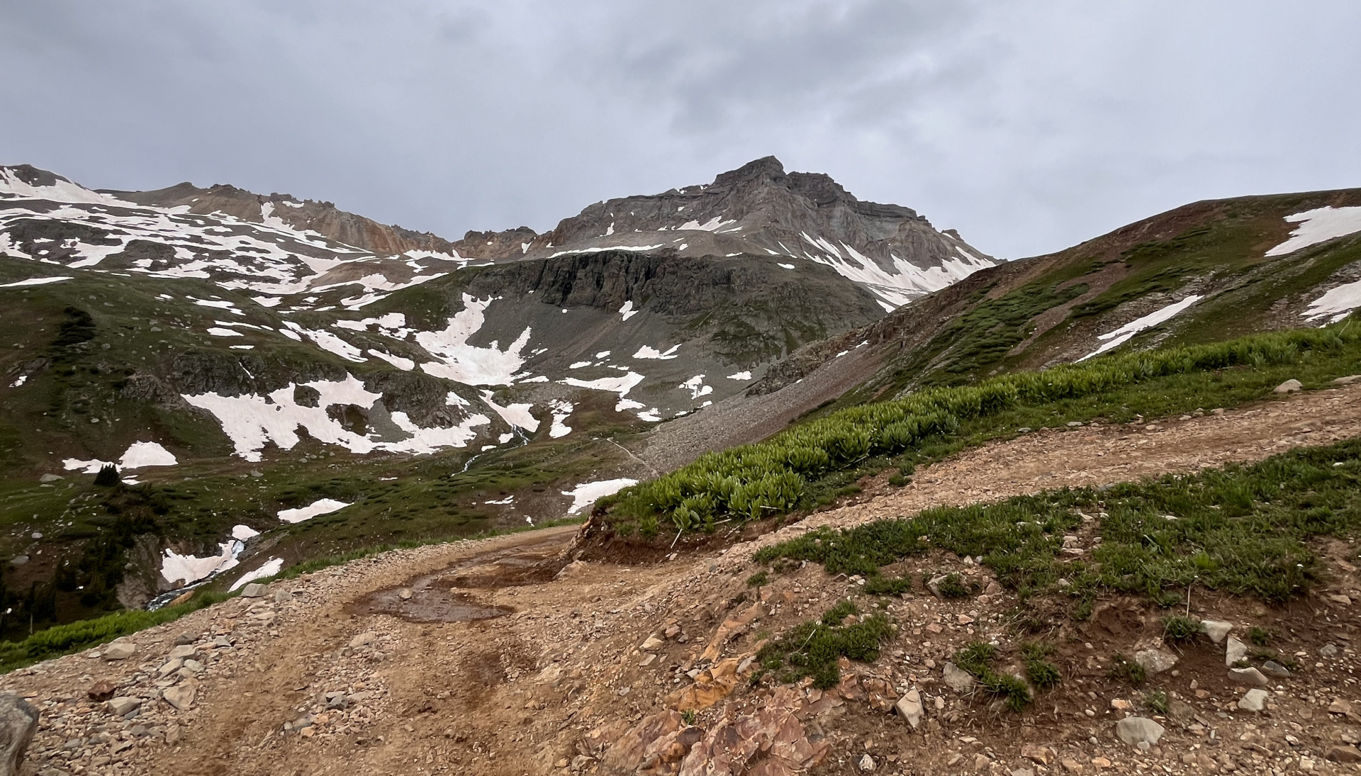
We reached a large snowbank along the trail at 11,450ft of elevation and let the dogs run and play. The high elevation tired them out quickly and we also had a brief rain shower, so we loaded back up and continued to the top. The wind picked up a bit, so we all put on our coats, took a couple of photos, and made our way back down.
Manual 1 or Trail Control?
On the descent, I found myself switching between Manual 1 for the engine braking and Trail Control at 1.5-2.5 mph, depending on the trail condition. They were amazed at how well the Bronco handled as well as the comfort of the ride.
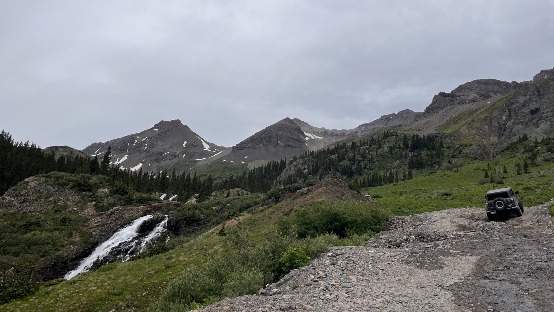
Fording Creeks and Finding Waterfalls
At the junction of the Yankee Boy trail with the Imogene trail, we had lunch and then continued up Imogene to the waterfall. We had checked the conditions and knew that Imogene was only open on the Ouray side so you couldn’t continue to Telluride. We took several more pictures and enjoyed fording Sneffel’s creek, which was about 30” deep. For a short section, the creek had overflowed the trail and we drove through the water for several yards, just below a small waterfall. The air temperatures hovered between 50 and 60 degrees, making it comfortable in my flannel. Brian likes a coat once temps dip below 35 or so.
A Great Bronco Trail Day
We made our way back down to Ouray and had dinner in town at one of the lovely and rustic restaurants. It was an incredible trail day and one that I highly recommend for Bronco owners but probably too much for a Bronco Sport.
Have you driven Yankee Boy in your Bronco? How did it go? Share your photos or trail stories in the comments.
Comments
You must log in or register to post here.