
The Rimrocker Trail is a 160-mile overland route that connects the little-known town of Montrose, Colorado, to the very popular off-roading destination of Moab, Utah. This mix of dirt, rocky trail, and even some gentle pavement has so much diversity, taking you from alpine forests to red rock canyons.
Here’s a route that offers a scenic and adventurous journey and maybe just one you’d like to explore yourself this summer.
Trail Overview
For the beginner to seasoned overlander, this trail has it all. There are plenty of places to jump on and off the trail, along with more difficult side and alternate routes to splice together to make this an easy weekend to a rugged one-week adventure, especially if you want to check out some of the aptly named rockcrawling trails in Montrose, not to mention iconic Moab.
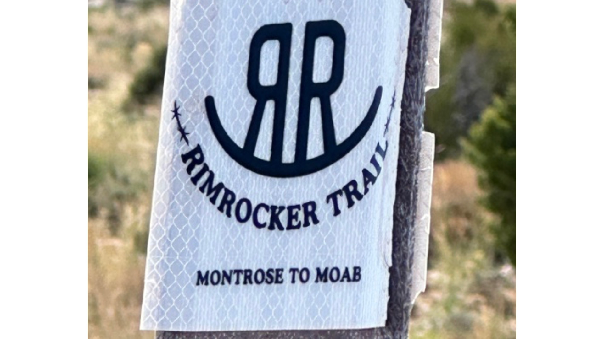
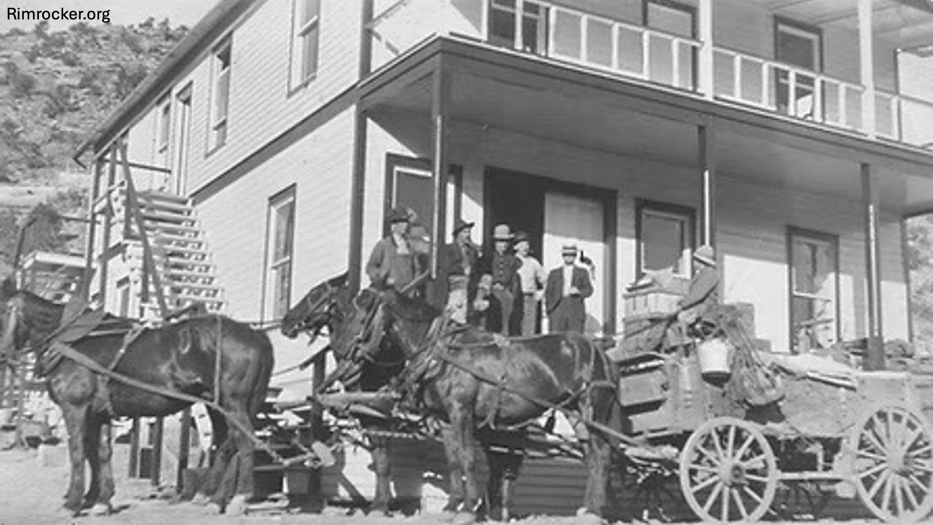
Although this trail was “officially” established in 2016 with the distinctive RR trail brand, the roads and paths that make up the Rimrocker are far older. The word Rimrocker itself refers to the miners who worked and lived in the mining communities located in the rocky areas traversed by the trail.
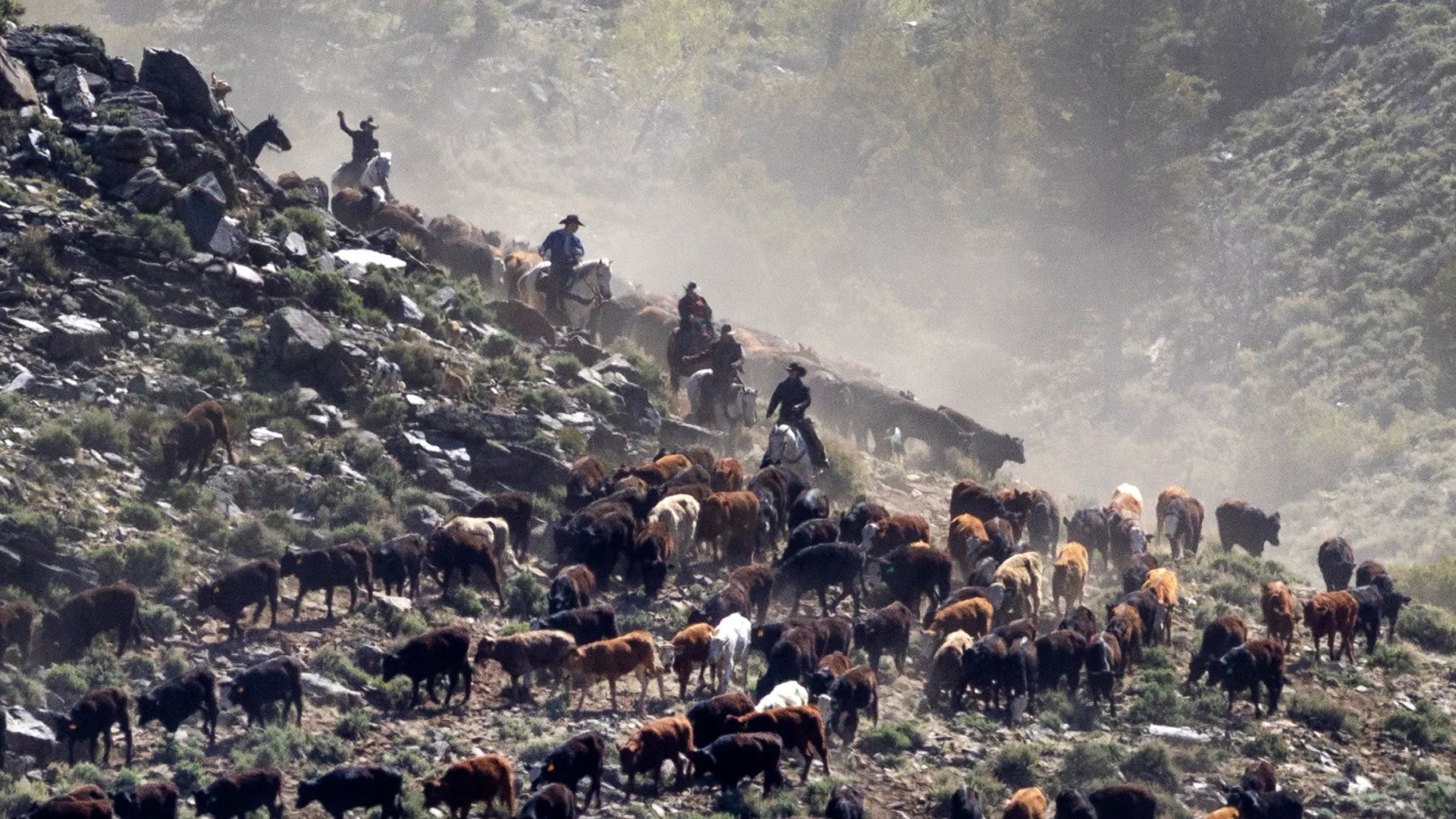
Several sections of the trail were originally horse-drawn wagon routes built by privateers to access the timber, grasslands, and other resources or to move cattle to the railroad. Cattle drives are still common along these routes and can make for a “fun” and interesting traffic jam.
Access Points
Although a full transit requires starting or ending in Moab from Montrose, there are other routes that can shorten your journey. One is at mile 31 (from Montrose) on the 25 Mesa Rd, taking you to Delta, CO. There are also times when the route is very close to or crosses pavement. When planning this trip, you can request paper maps or use interactive ones online. The Rimrocker website also has maps that can be downloaded into your favorite apps (OnX, Gaia, etc).
To get to the trail from Montrose: Begin on State Highway 90 westbound, which transitions into 90 Road. Follow the route through several 90-degree turns to reach the trailhead.
And from Moab: From the Maverick gas station on the south side of Moab, drive south 11.8 miles on US 191. Turn left onto Blackridge Road (also known as Pole Canyon Road or CR 173).
Where to Camp
There are lots of places for dispersed camping along the trail or up some of the side trails. Best practices for dispersed camping include only setting up camp on already disturbed land. You can usually find a campfire ring someone has left. Check the website or watch for signage to areas that are open for camping.
Also watch for fire restrictions and follow them carefully, thoroughly extinguish fires with dirt. Wildfire in Colorado and Utah is a real fear so be a good visitor.
There are also some formalized camping and toilets at:
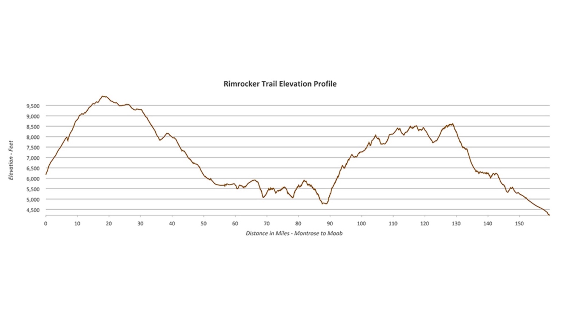
Iron Springs (Mile 15.6) Elevation: 9600 ft
Columbine (Mile 21.7) Elevation: 9000 ft
The Ballpark at Historic Uravan (Just before Mile 69, follow V19 road west and cross 141). Elevation: 5000 ft.
Buckeye Campground (Mile 107.6) Turn past reservoir Elevation: 7600 ft
Mileage is from Montrose.
If camping is not your thing, there are a few hotel rooms and cabins along the way. Montrose and Moab have several hotel options but on route, unless you want to travel several miles, you’re pretty limited to a few options in Naturita, CO like the aptly named Rimrock Hotel or the Paradox Valley Inn (which requires a pretty big detour). If you can tolerate a day or two in a tent, you won’t be disappointed. Hey, invest in a Bronco hammock and you won’t even have to set up a tent.
Highlights Along the Trail
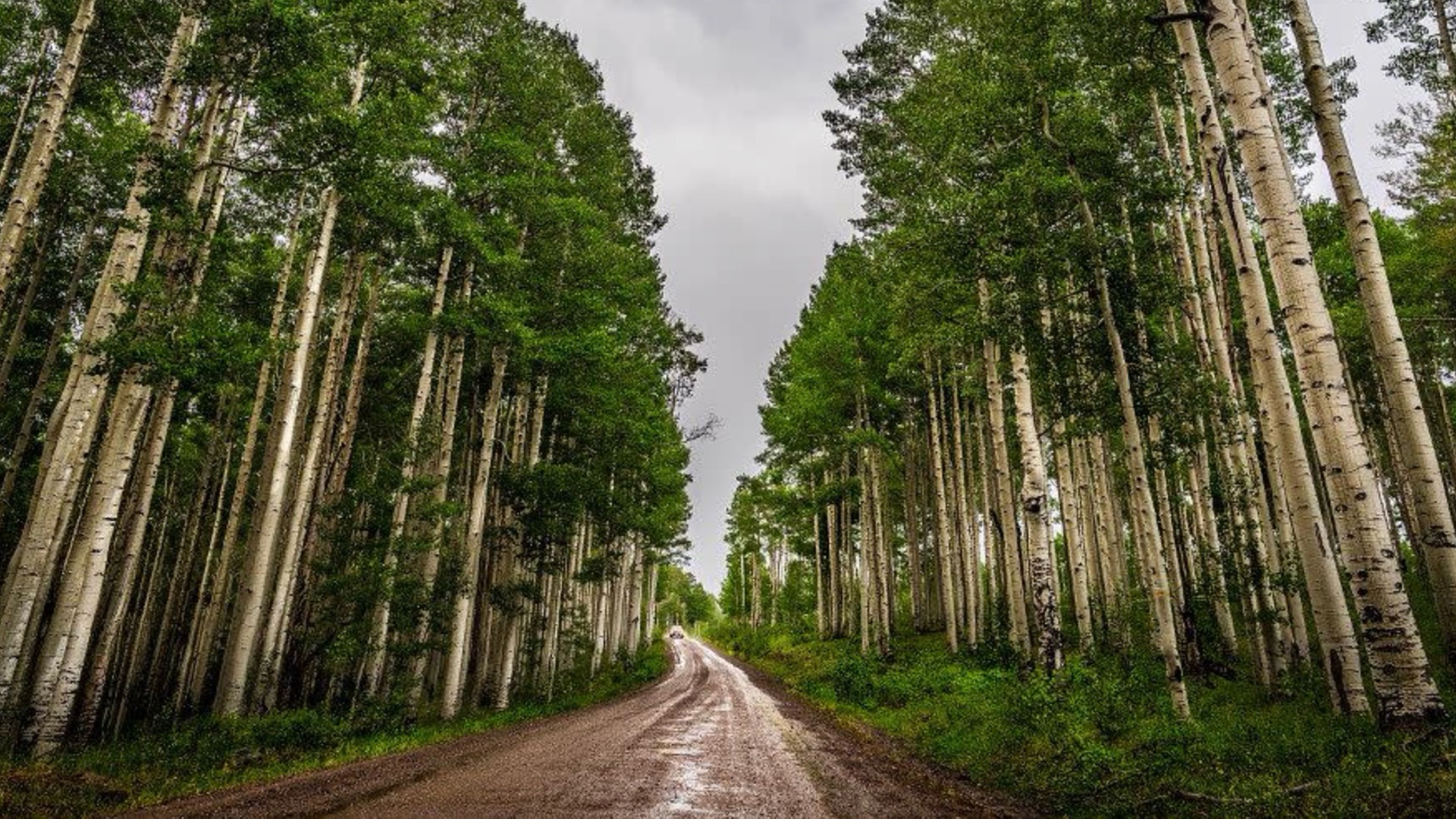
Uncompahgre Plateau: Experience high-elevation forests and expansive vistas in this 1.5 million acre area, managed mostly by the National Forest. Named by the Ute Indians, Uncompahgre means “rocks that make waters red”.
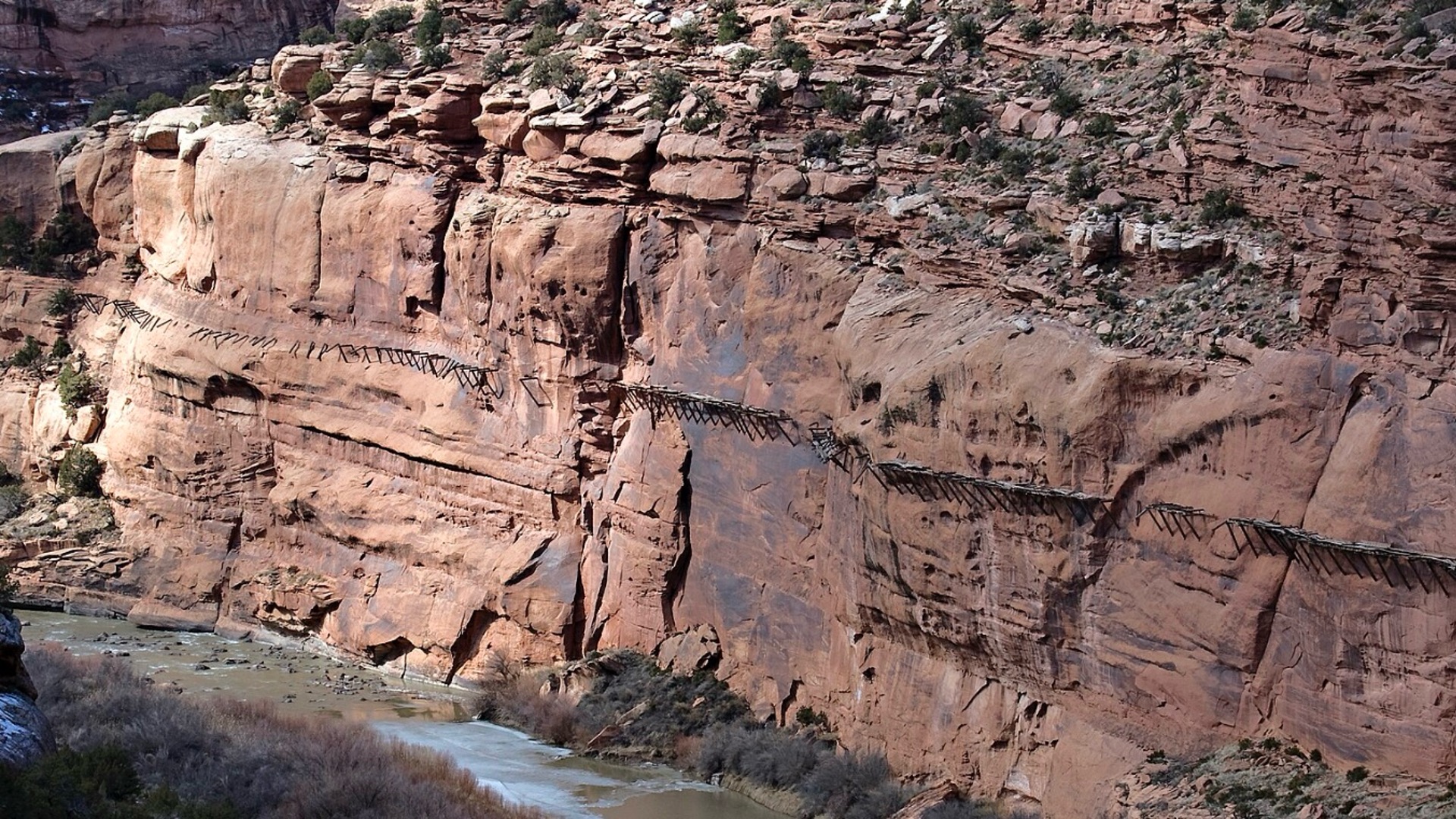
Historic Mining Sites: Discover remnants of the region's mining history, like the Hanging Flume, at Mile 82.7.
La Sal Mountains: Traverse alpine landscapes with opportunities for hiking and wildlife viewing.
Red Rock Canyons: As you approach Moab, the terrain transitions to iconic red rock formations and desert scenery.
Best Time to Visit the Rimrocker Trail
The elevation of this trail system varies wildly but the lowest elevation is in Moab, at about 4500 ft. Much of the route beginning in Colorado is well above 6,000 ft up to almost 10,000 ft. This means that the trail is closed in the winter and may not open until late spring. This year, in 2025, the trail officially opened on May 2nd. But, for those who love wildflowers and cooler temperatures, the Rimrocker can’t be beat in June, compared to the triple digits in Moab.
Early fall is also a wonderful time to visit as the high alpine prepares for winter with a spectacular show of color as the leaves begin to change. Be prepared for cold overnight temperatures and watch for updates on trail conditions. Colorado had a mild fall in 2024, leaving the trail open until January 8th but that is not typical.
Basic Travel Guidelines for Rimrocker Trail
Don’t forget all your essentials for camping and off-roading safely. Also consider the higher elevations and make sure you have warm clothing and rain gear for those unexpected mountain storms. There are some areas where cell signal is present but long stretches without it, so let your family at home know where you are and check in often.
Make sure you start will a full tank of fuel and top your tank when coming into Nucla at mile 54. After this point, there’s no fuel until you reach Moab.
There are also stream crossings of Tabeguache Creek which may have deep water, especially during spring run-offs so use extreme caution before driving across.
Rimrocker + Bronco = An Amazing Experience
Embarking on the Rimrocker Trail with your Bronco offers an unforgettable adventure through some of the most stunning landscapes of the American West and I hope you’ll add it to your bucket list. Whether you're seeking solitude, natural beauty, or a connection to the region's rich history, the Rimrocker trail delivers a comprehensive overlanding experience.
Have you driven the RimRocker trail? Tell us about your trip in the comments.
Comments
You must log in or register to post here.