
Spring is here and thoughts are turning to trail rides and adventures in our Bronco Sports. If you’re like me, you may be hesitant to take your Sport out on the trails because there are mixed reports in what is an easy trail vs. what is suitable ground clearance for a Sport to tackle. Many of you may be planning on a Moab visit this year and if so, I’d like to provide you with my favorite Bronco Sport trails that I’ve driven several times in my stock Badlands trim.
When venturing out, make sure you have a good trail app that will show your position on the trail (or paper maps and a sound navigator), bring recovery equipment, have snacks, and plenty of water. Let someone know where you’re headed, go with others if possible, and be prepared for changing trail conditions. If the trail seems beyond your comfort zone, turn around. You can check on current trail conditions by calling the Moab Field Office at 435-259-2100.
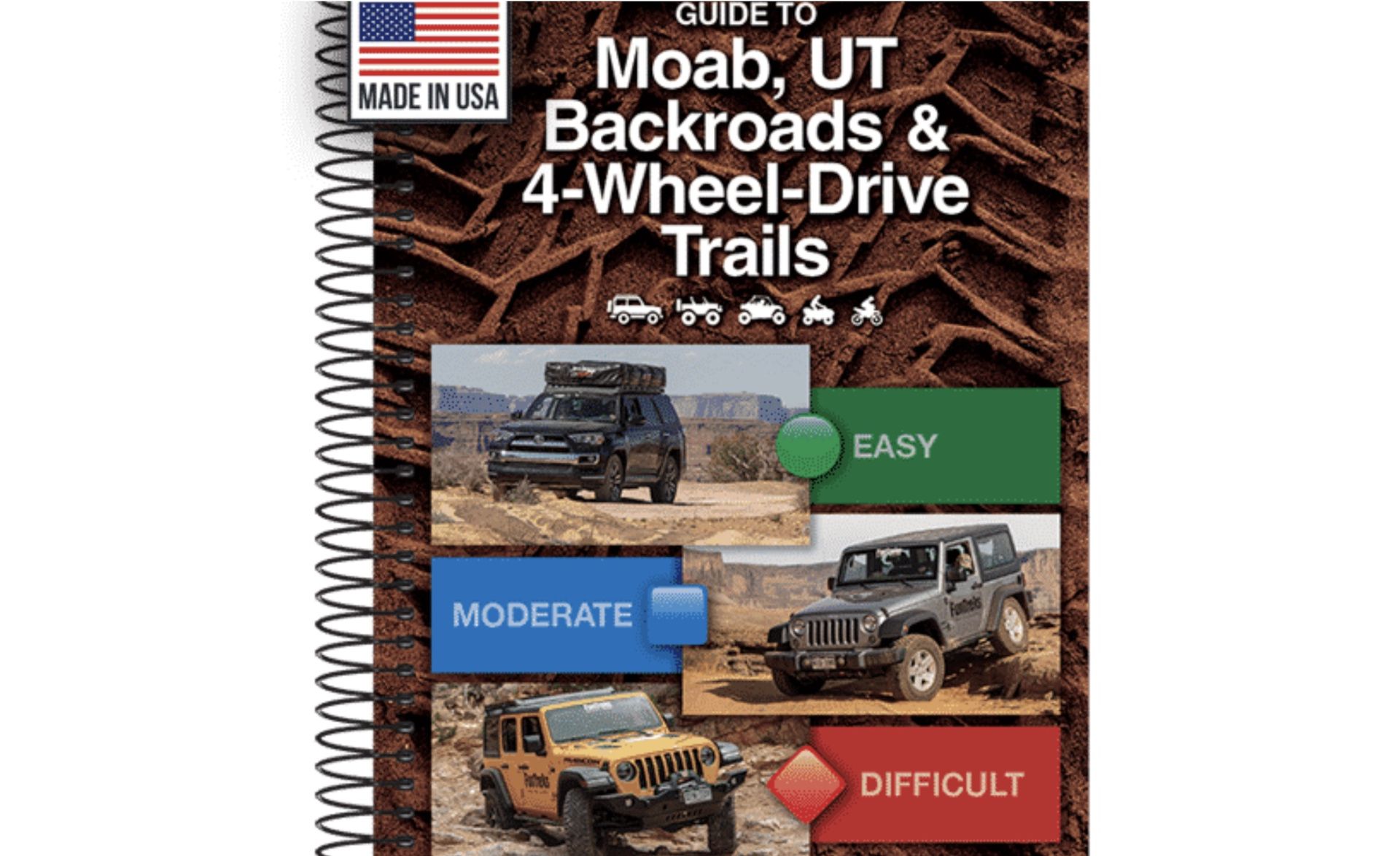
My resource guide for Moab trails is the FunTreks Guide to Moab, UT Backroads & 4-Wheel-Drive Trails, written by Charles Wells & Matt Peterson. Here's a link: Moab Guidebook. I’ve carried editions of this book for years and now, on the FunTreks website, you can download the .gpx maps of these trails at no charge. When I first started running trails in Moab, I would write down the date and check the trail off the list in my book, often writing notes in the margins. It’s a fun souvenier.
Now, let’s get down to talking trails.
Schafer Trail
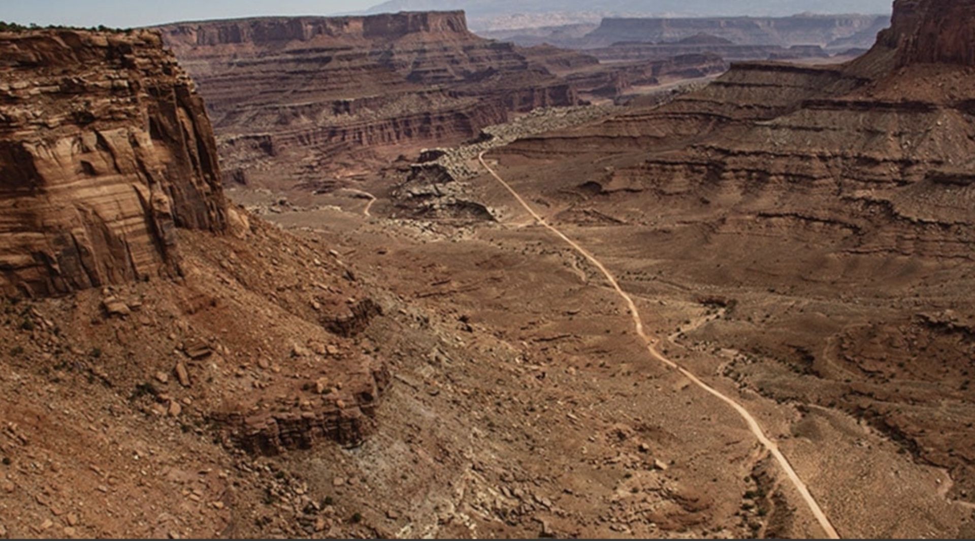
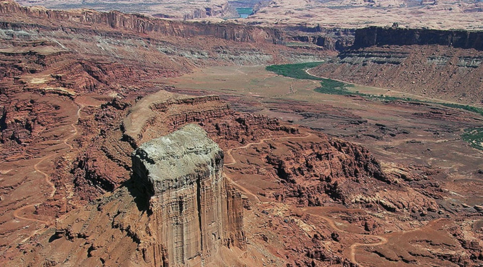
Probably one of the most spectacular trails in both scenery and trail design, and what is often referred to as the Schafer Switchbacks, connects between the Potash Rd. and Canyonlands National Park, Island in the Sky district. If a visit to Canyonlands is on your list, driving this route gives you a real taste of the park, away from the paved roads. This is not a rarely traveled route, it’s likely you will encounter a fair amount of traffic and you’ll need to watch carefully as you begin tackling the switchbacks, as passing is really only possible in some corners and constructed pull outs. Uphill travel has the right of way but coming bumper to bumper with another vehicle, knowing someone has to back up, is not something you’ll look forward to.
Now, don’t let that dissuade you, I’ve driven this trail dozens of times and never had any issues, I just pay attention and respect others on the route.
The trailhead is the end of the Potash Rd, which you can access by driving north from Moab on Hwy 191. After you cross the river bridge and before you get to the Arches National Park entrance, you’ll see a green sign signaling the Potash Rd (Hwy 279) on the West (turn left). The road is paved for several miles but transitions to dirt at the Potash plant, at about 17 miles. You’ll begin making your way through the evaporation ponds, just don’t turn onto private roads, which should be signed. The route might be a little rough but will smooth out, watch dropping in and out of washes, as these can develop ledges based on the weather. At about 8.6 miles in, you’ll see a faint road that runs along a cliff edge, this is Thelma & Louise point, where the duo jumped their car at the end of the trail.
Continue on, you’ll enter the National Park and see a campground on the right. There’s a bathroom here if you need it. Shortly after, you’ll come to a junction with the White Rim trail. You need a permit to travel that way, continue on to the swithcbacks. Put your Sport into Low or Rockcrawl and slowly make your way up, watching for descending vehicles. Follow the canyon around until you reach the pavement. Turning left will bring you to the Island in the Sky Visitor Center, turning right will take you back to 191 or to Long Canyon if you haven’t had enough adventure for one day.
Long Canyon
This is another beautiful trail that is sometimes combined with Schafer to make a full day loop trail. Check trail conditions, if you don’t find any information, you can drive to the trail head and see if there is a road closed sign posted there. The roughest part of the trail is usually encountered in the first half mile, called Pucker Pass. I’ve seen it with a pretty decent ledge, and I’ve seen it very smooth, so get out and evaluate before attempting it. You might want to check out Dead Horse State Park while you’re in the area. Great mountain bike trails, easy hikes, and amazing overlooks of the Shafer trail.
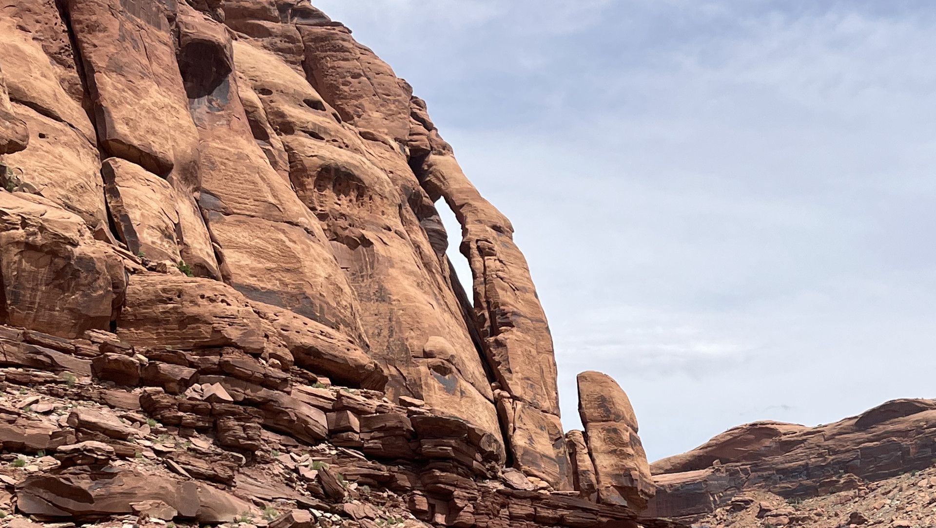
Finding the trail head is easy. Turn on the paved road 313 towards Dead Horse Park but instead of taking the sharp right turn at about 1.5 miles, continue straight onto the gravel road, heading east. Another 3 miles and you’ll turn sharply, descending into a canyon. Now you’re heading on to the Long Canyon trail. You’ll eventually pass under a giant rock tunnel and continue to steeply descend, eventually reaching the Potash Rd. Look to the left and check out Jug Handle Arch before turning left and heading back to Moab.
Gemini Bridges Road
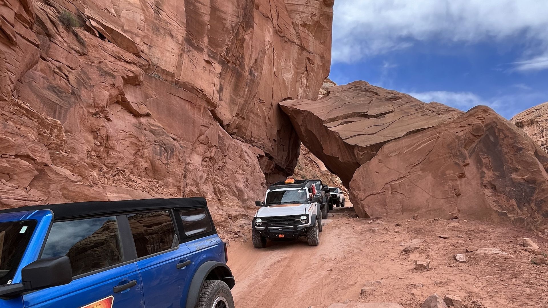
Gemini Bridges is a double arch, and this route is popular with mountain bikes and rock crawlers, many accessing difficult trails like Metal Masher and Gold Bar Rim. Getting to the trailhead is easy. Just drive north of Moab on 191 about 9 miles and you’ll see the green sign pointing west to Gemini bridges. There is a paid campground and staging area but drive on, turning left after crossing the railroad track, and onto the gravel road. At about mile 2, you’ll turn west and begin climbing the shelf road. At just past mile 4, you’ll see Gooney Bird Rock, just left of the road. Local lore is that Gooney Bird guards the trails, and it’s good luck to drive over his toes. Another .6 mile will bring you to an intersection, you’ll want to take the right choice, going up the hill, not staying in the wash. It will begin getting rockier and you might need to pick your way through, use good judgement if it’s too rough. You’ll reach Gemini Bridges, you should really hike the short trail to see and walk across them. From this point, you can either continue the route, eventually reaching Hwy 313 and turning right will bring you back to Hwy 191 or you can turn around, retracing your route.
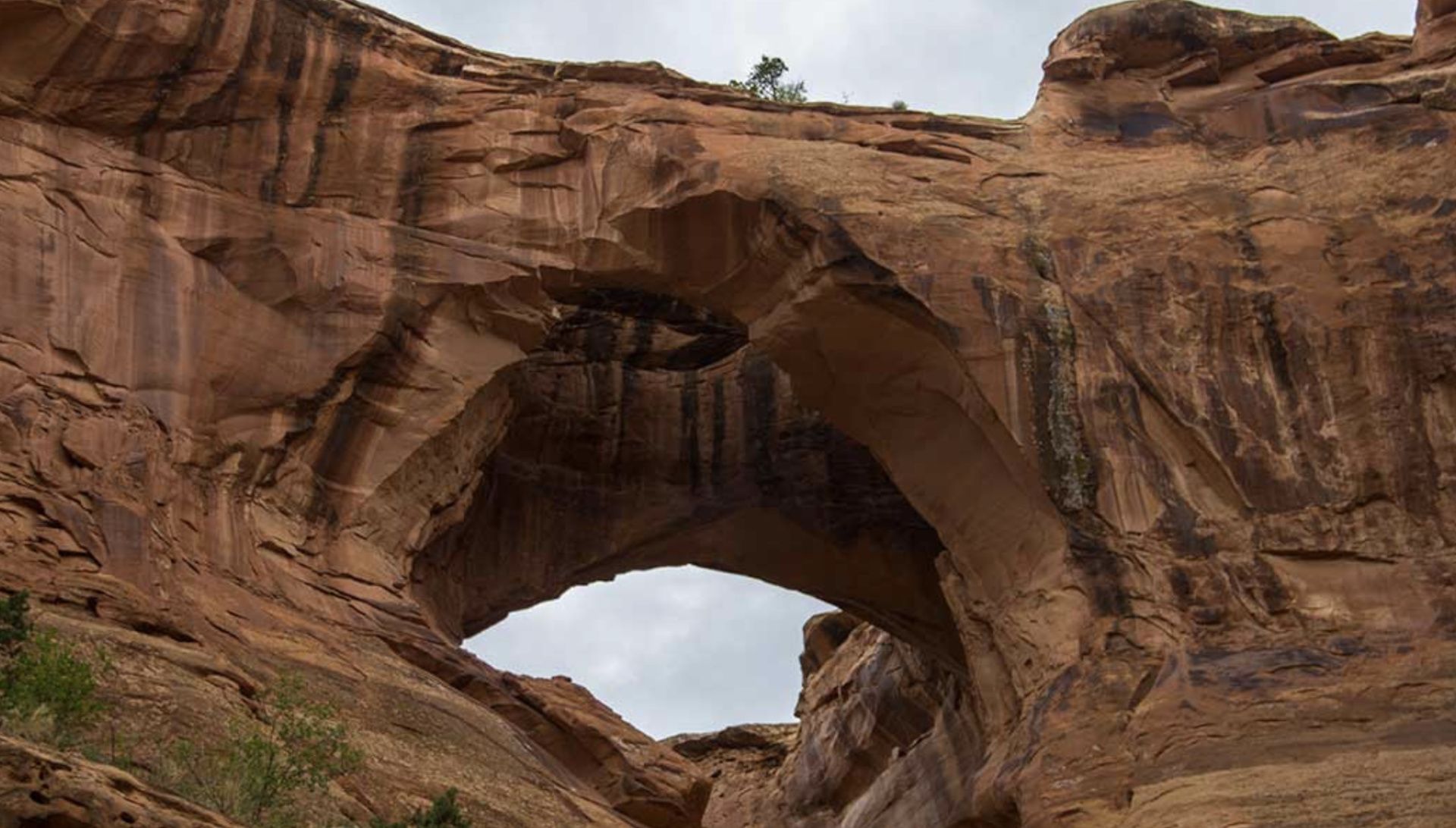
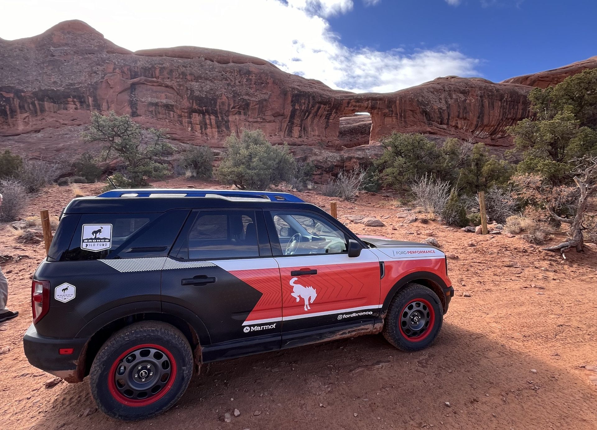
Picture Frame Arch
There’re actually two arches in Lone Rock, an isolated and distinctive mesa located in what’s known as the Behind the Rocks area. Use your guidebook and good maps here to insure you stay on or near the county road as routes to the south can get very rocky and challenge even the most well-built 4x4 vehicles.
The road is located at the top of Blue Hill, which is on Hwy 191, about 12 miles south of Moab. It’s easy to find the road as Hwy 191 provides a passing lane going up Blue Hill, with slow moving trucks often found in the right lane. At the top of the hill, the lane closes, and you’ll see a cross roads sign. You’ll want to turn right here. You’ll stay straight and then the road quickly bears right. Stay along this route for about 2.7 miles where you’ll reach a sandy wash. The main route climbs the hill but turning right will take you through a twisty, fun trail that reaches a small sand dunes complex. Use caution if taking the wash as it can have deep sand and getting stuck is a possibility. I put my Badlands in Sand Mode and take that route every time. If you’re by yourself though, you may want to stay on the main route. You can reach the dunes from the county road.
After the sand dunes, get back on the county road and head towards Lone Rock to the southwest. The road will take you directly there. Just before reaching Lone Rock (locals often refer to this rock as Prostitute Butte), you’ll see well-traveled routes that take you to Balcony Arch, which also had dispersed camping.
Staying on that route to the south will take you around the rock to Picture Frame Arch. As you begin curving around the south end, the trail becomes rockier with more options. Find a good line and have your spotter ready or park and hike the short distance to the Arch. We typically stop here with the Sports as the trail has larger ledges on the west side but travel on if you feel comfortable. The trail will reconnect with the county road, you’ll want to turn back east as the road degrades and gets too challenging for Sports.
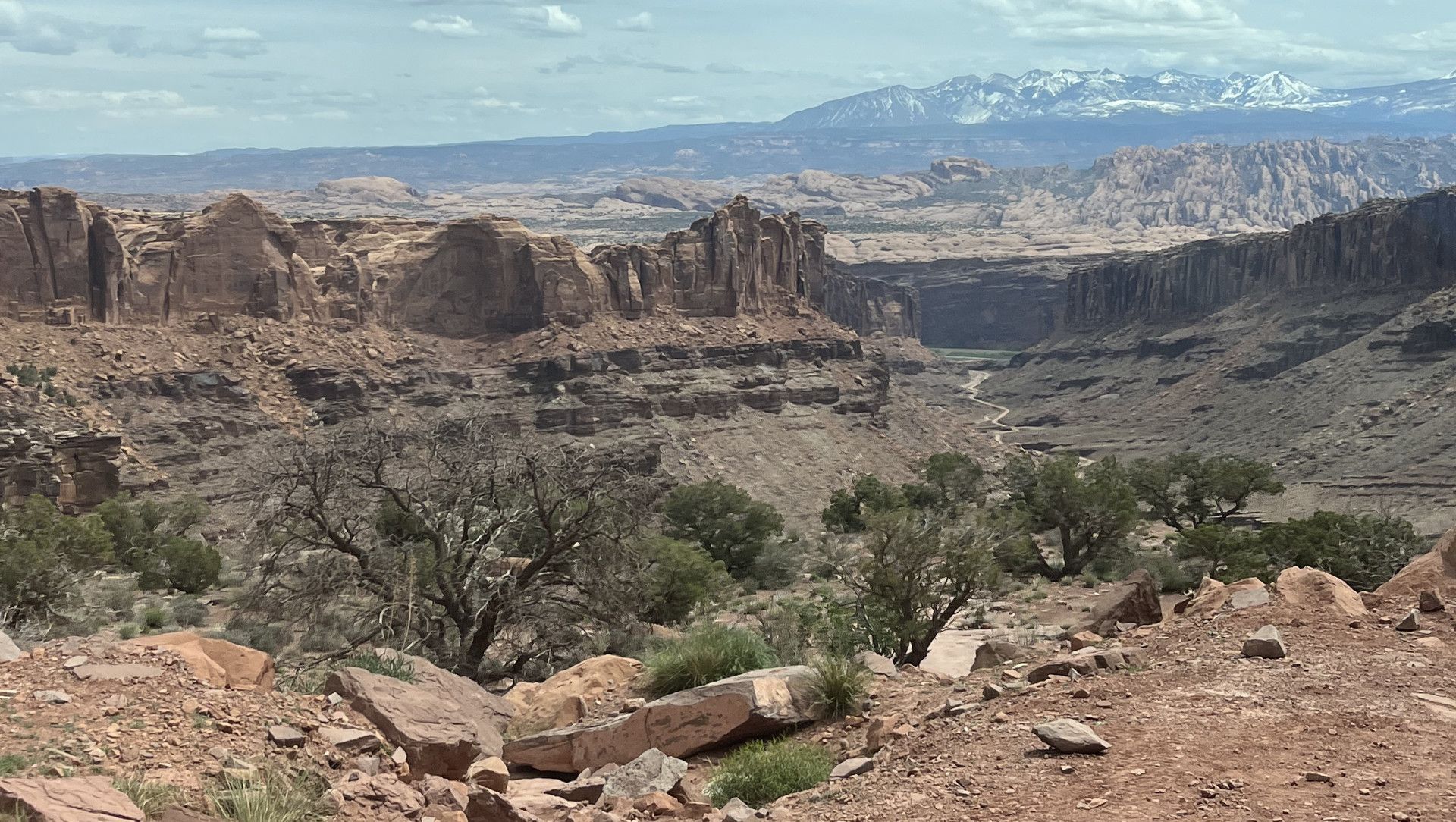
Hurrah Pass
This beautiful overlook of Canyonlands is part of the larger Chicken Corners trail. Chicken Corners has some larger ledges so proceed at your own risk, you’ll probably want a higher clearance vehicle.
Hurrah Pass is accessed by traveling down Kane Creek Rd. You’ll turn West at the stoplight by the McDonald’s, that’s the start of Kane Creek. This road travels along the river, headed through what locals call the Portal (the narrow rock opening that the Colorado river runs through), and past challenging trails like Moab Rim and Pritchett Canyon. The road transitions to dirt and becomes narrower, passing the Cliffhanger trail head, Birthing Rock petroglyphs and descending tight switchbacks to the creek.
This drive is phenomenal in regard to scenery. It’s also a great camping area, with several BLM (Bureau of Land Management) campgrounds if you’re looking to stay and see the star filled night skies. The road eventually turns from south to west, you’ll see Kane Creek trail on your left (you don’t want to go that way). Keep on the wider road that will begin climbing and switch backing to Hurrah Pass. This is an out and back trail so after getting all your photos at the top, you’ll make your way down for the return trip to Moab.
Have you driven some of these routes in your Bronco Sport? Comment below or let me know of your favorite Sport trails in the area.
Comments
You must log in or register to post here.