Here at Bronco Nation, we get excited about Broncos, and we get excited about the special, out-of-the-way places that Broncos can take us. In this series, we’re going to cross the country, highlighting a few of the best trails in each region. Before you go off-road, you want to know what type of terrain you can expect and what equipment you should pack, so you can have the best trail ride ever.
COLORADO
Any experienced off-roader will tell you: Colorado has some of the best trails in the U.S. Whether you are a beginner or ready for a serious challenge, check out our recommendations below to find an unforgettable drive. Just be careful that those beautiful, forested mountain views don’t draw your attention too far from the trail!
On these trails, you’ll find obstacles ranging from large boulders to treacherous loose shale, and a variety of water crossings. On the more difficult trails, you also navigate narrow shelf roads carved out in pre-motoring times that lead to derelict 18th century mining towns. Many trails in Colorado will be closed for a significant portion of the year due to snowfall, so even in summer, check for seasonal and weather-related closures. Some of Colorado’s historic sites remain private property, just another reason to take time to familiarize yourself with your route before you hit the trail.
In order to protect your surroundings and yourselves, you’ll need to plan and prepare. Pack a first aid kit, plenty of water, and weather-appropriate clothing. Bring a tire gauge and an air compressor, so you can air down and back up. And bring a recovery kit so that if you get stuck, you can get unstuck. If you’re not experienced using this gear, bring along friends who are, who can pass their knowledge along to you. Not sure where to find those knowledgeable friends? Join the community conversation in the Bronco Nation forums! Finally, when you’re heading into the wild, you’re heading out of reliable cell-phone coverage, so bring paper maps or a dedicated GPS unit. At Bronco Nation, we highly recommend the venerable but recently updated FunTreks Guide to Colorado Backroads & 4-Wheel-Drive Trails.
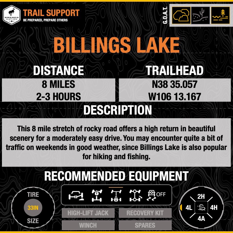
Billings Lake (C.R. 240)
Location: Off US50, west of Salida and Poncha Springs
Terrain: This 8-mile stretch of rocky road offers a high return in beautiful scenery for a moderately easy drive. You may encounter quite a bit of traffic on weekends in good weather, since Billings Lake is also popular for hiking and fishing.
Considerations: You’ll need high clearance on your rig to manage the uneven surface of this trail. Two trails near Billings Lake (Palisades and Tomichi) have been closed by landslides in recent years and feeder roads may be closed by snowfall.
G.O.A.T. Modes to Consider: Mud and Ruts or Sand (with 4L selected)
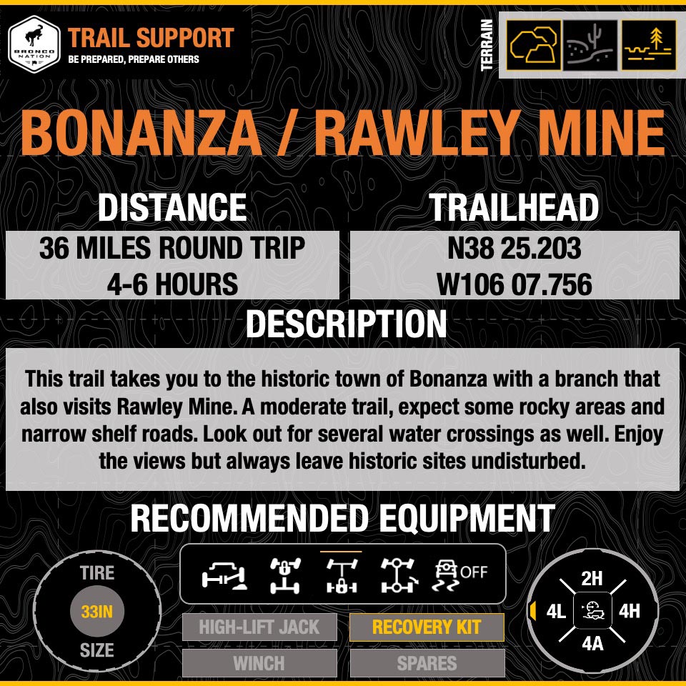
Rawley Mine, Bonanza
Location: off US285, south of Buena Vista and Poncha Springs
Terrain: Driving this route up to the town of Bonanza and back, you’ll cover about 30 miles of fairly easy gravel road. There is one long, narrow climb that may require you to back up a considerable distance if you encounter an oncoming vehicle.
Considerations: This trail offers one of the best opportunities to get a close look at standing, historic mine buildings. In fact, the former boomtown of Bonanza still has a few residents, so be mindful of private property.
G.O.A.T. Modes to Consider: Mud and Ruts or Sand
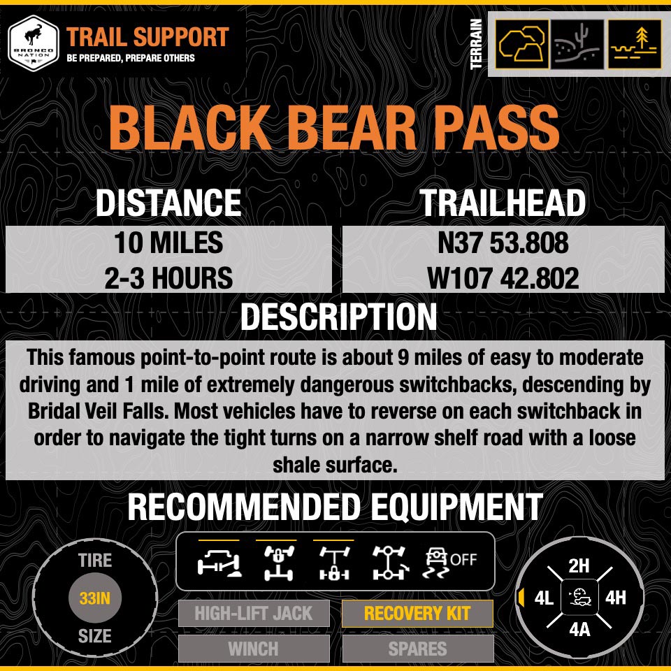
Black Bear Pass
Location: In the San Juan Mountains, between US550 and Telluride
Terrain: This famous point-to-point route is about 9 miles of easy to moderate driving and 1 mile of extremely dangerous switchbacks, descending by Bridal Veil Falls. Most vehicles have to reverse on each switchback in order to navigate the tight turns on a narrow shelf road with a loose shale surface. Bronco enthusiasts are eager to see how a new Bronco with Trail Turn Assist will tackle this obstacle. Considerations: The infamous October 2020 video of a Jeep rolling off this trail may be enough to cause some people to leave Black Bear off their bucket list. The switchbacks above Bridal Falls require a rig in excellent condition, trail experience, and caution.
G.O.A.T. Modes to Consider: Mud and Ruts or Rock Crawl, Sand in 4L
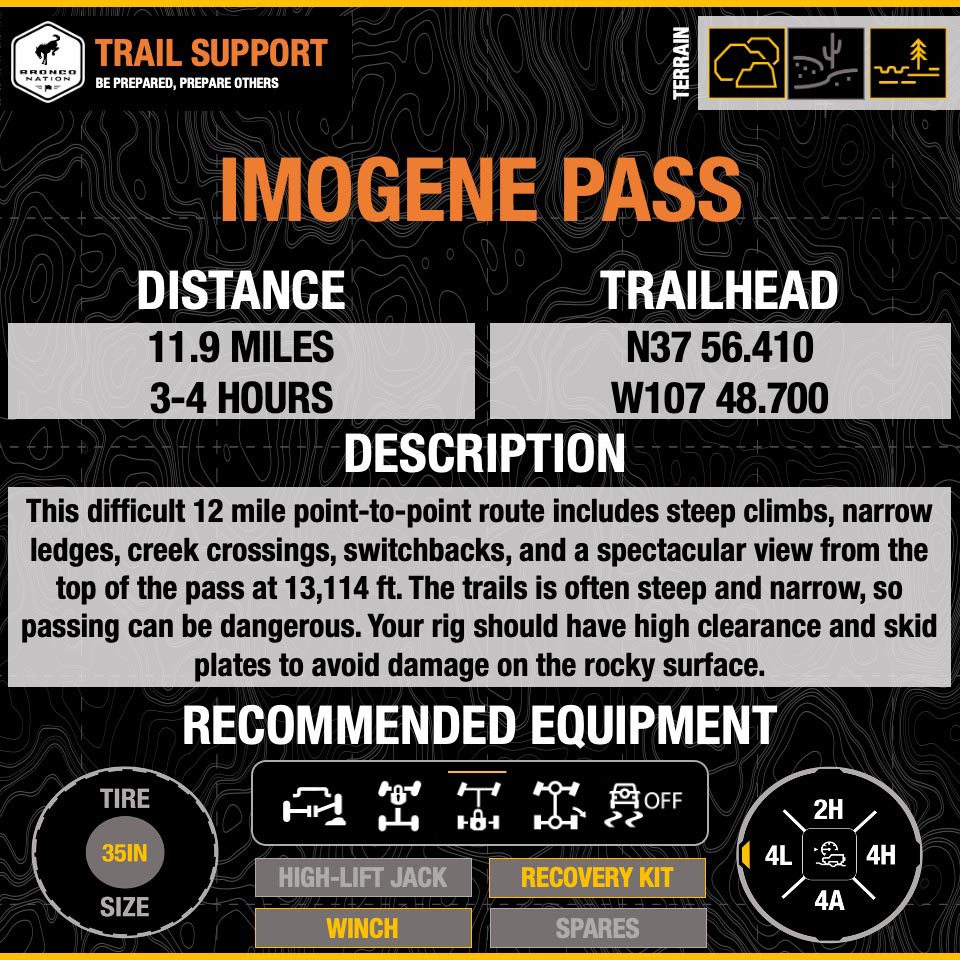
Imogene Pass
Location: In the San Juan Mountains, between Telluride and Ouray
Terrain: Just across the valley from Black Bear Pass, this difficult 12-mile point-to-point route includes steep climbs, narrow ledges, creek crossings, switchbacks, and a spectacular view from the top of the pass at 13,114 ft.
Considerations: The trail is often steep and narrow, so passing can be dangerous. The rocky surface requires your rig to have high clearance and skid plates to avoid damage due to the terrain. The FunTreks guide recommends beginning from Telluride rather than Ouray, which “allows you to drive downhill on the steeper, rockier north side.”
G.O.A.T. Modes to Consider: Mud and Ruts or Rock Crawl, Sand in 4L
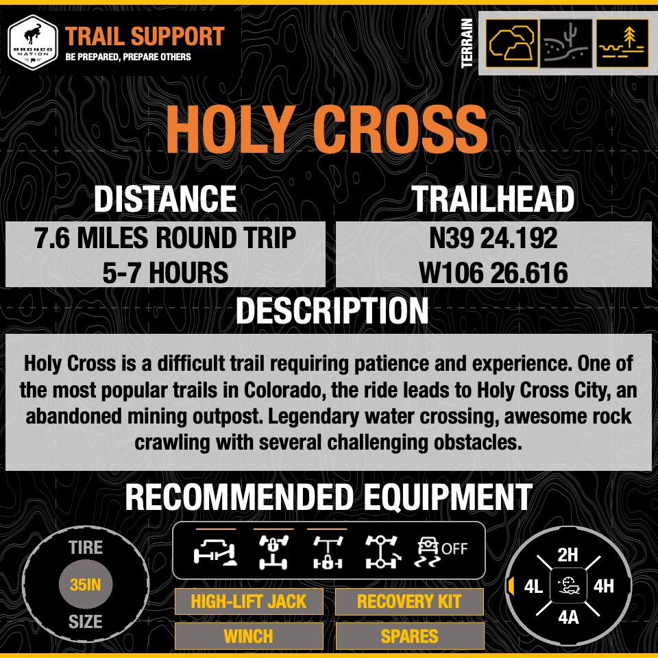
Holy Cross
Location: Off US24 south of Vail
Terrain: The most difficult trail we’re featuring, this 11-mile route up to Holy Cross City and back offers obstacle after obstacle for the experienced off-roader, including intense rock crawling.
Considerations: Even experienced drivers shouldn’t attempt Holy Cross alone, because you may need to winch across French Creek. Traffic may back up there as people attempt the crossing multiple times. You can take a breather and enjoy a lunch break with a view at the old mine town site at the top of the trail.
G.O.A.T. Modes to Consider: Rock Crawl

Comments
You must log in or register to post here.